LOGGING ON PUBLIC LANDS PHOTO GALLERY
Logging is promoted by agencies and the timber industry as necessary for public safety and for forest restoration. However, most logging on National Forests takes place in the backcountry, far from human communities. Logging in remote wildlands does not keep people safe. Home hardening, working around homes and communities, and emergency preparedness are far more effective strategies for protecting people and communities.
We need to protect biodiversity, clean water, and the climate.
Instead, we are losing the remaining ‘last-best’ habitat in our region to logging, and exacerbating the climate and biodiversity crises.
The photos below are only a few examples of the widespread, landscape scale logging taking place on National Forests and Bureau of Land Management lands in the Pacific Northwest.
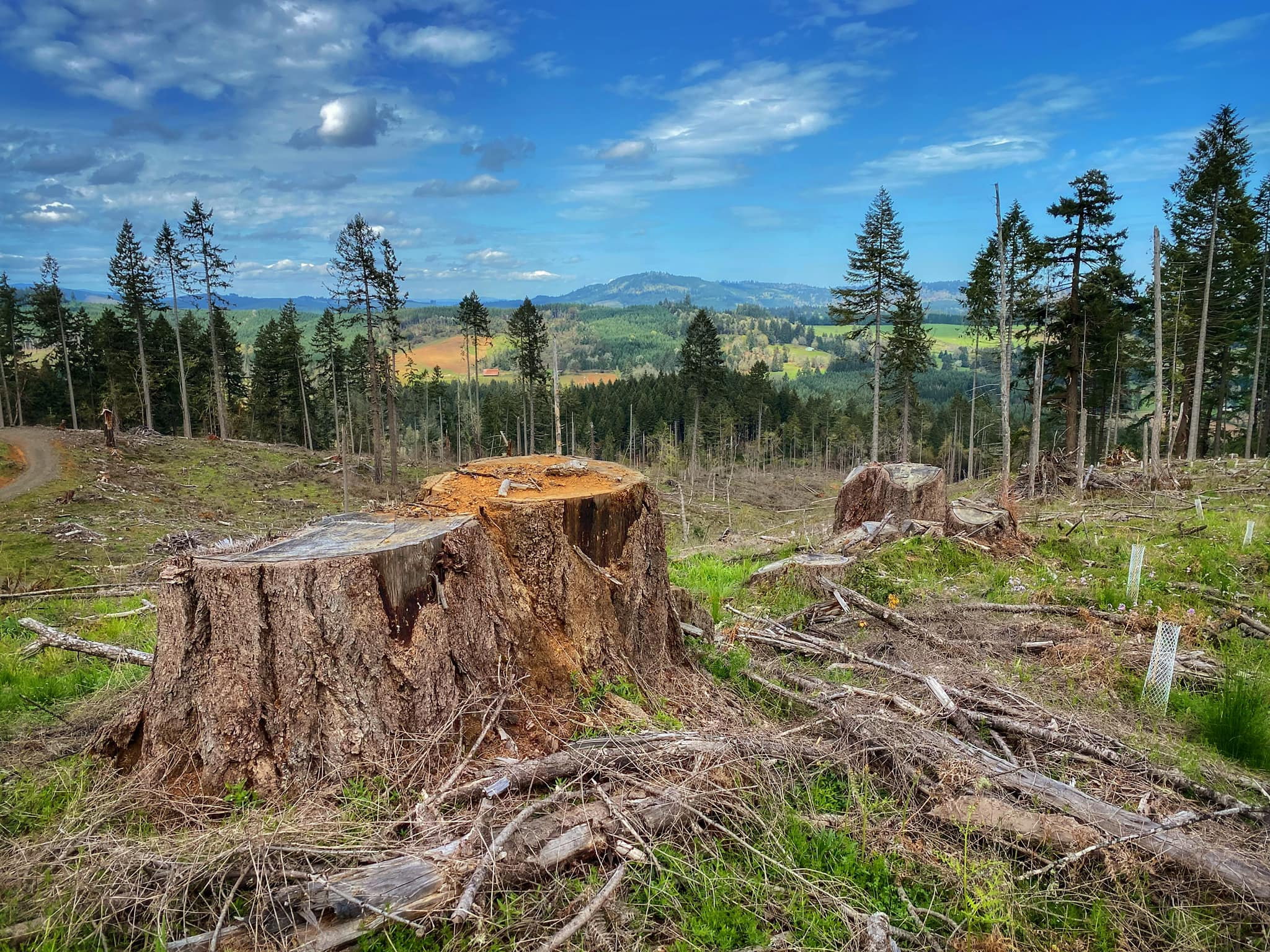
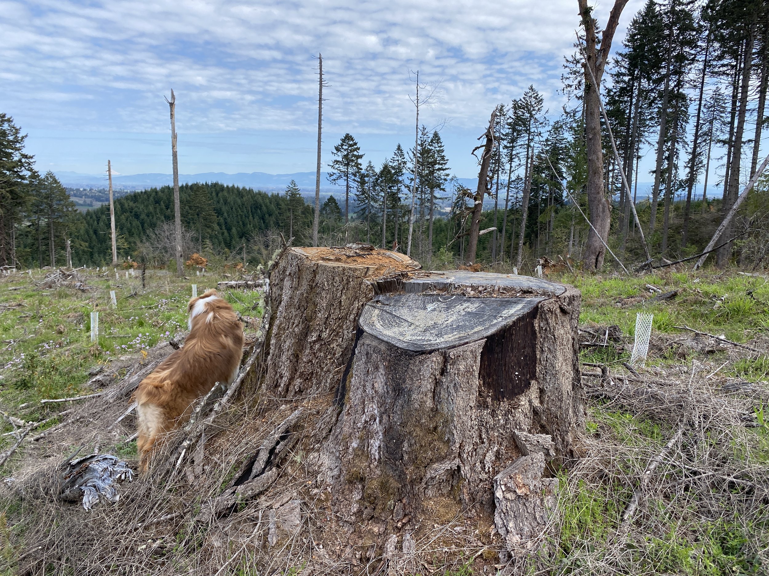
Photos of “thinning” on public lands:
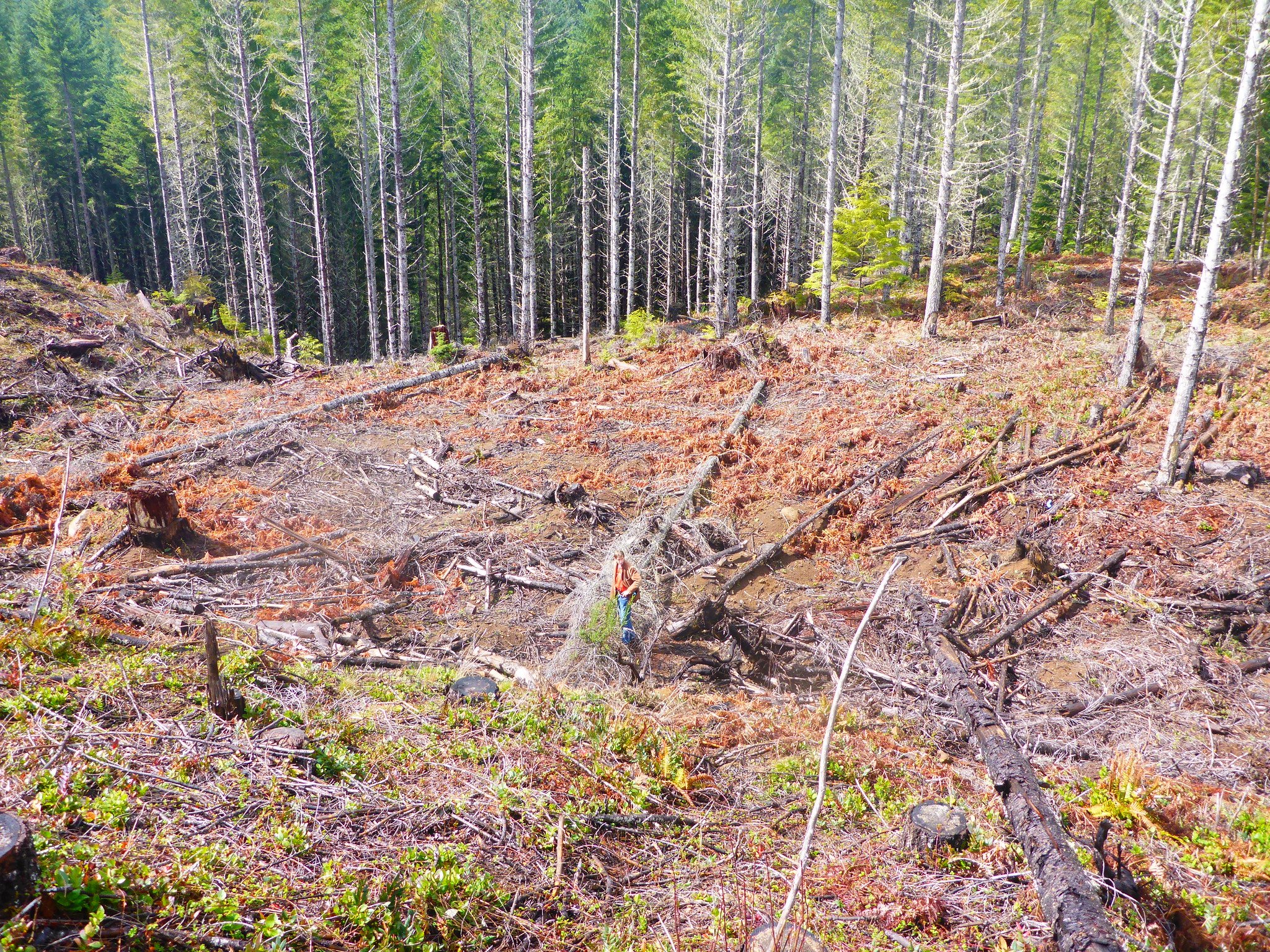
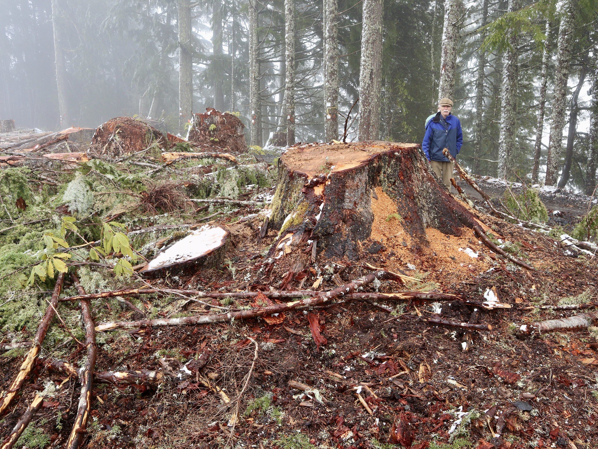
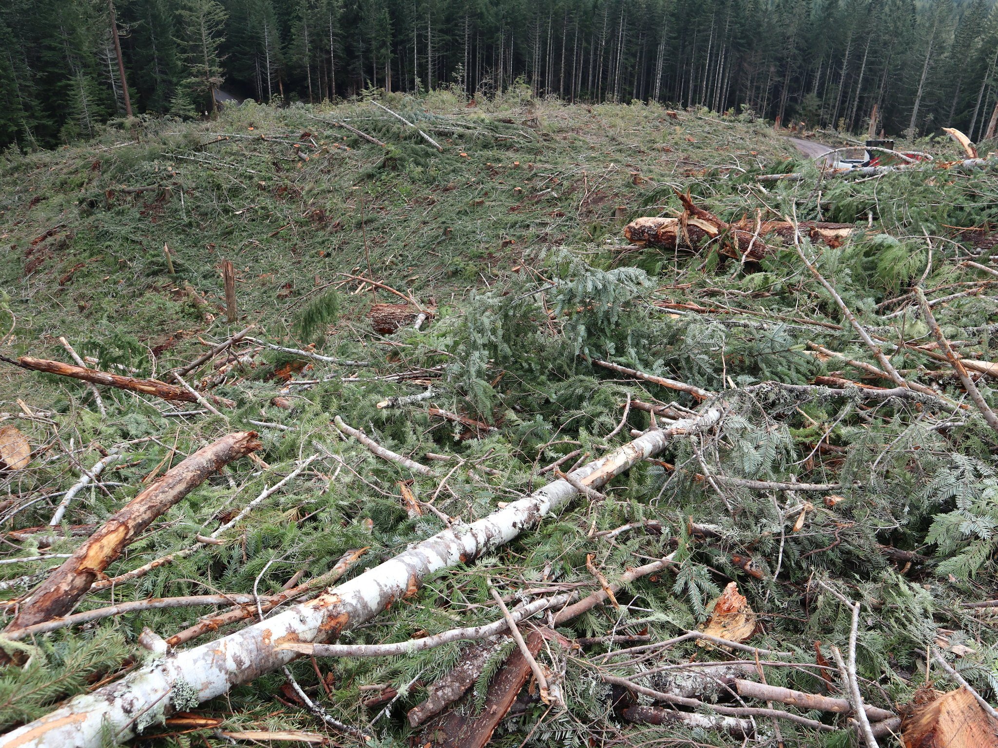
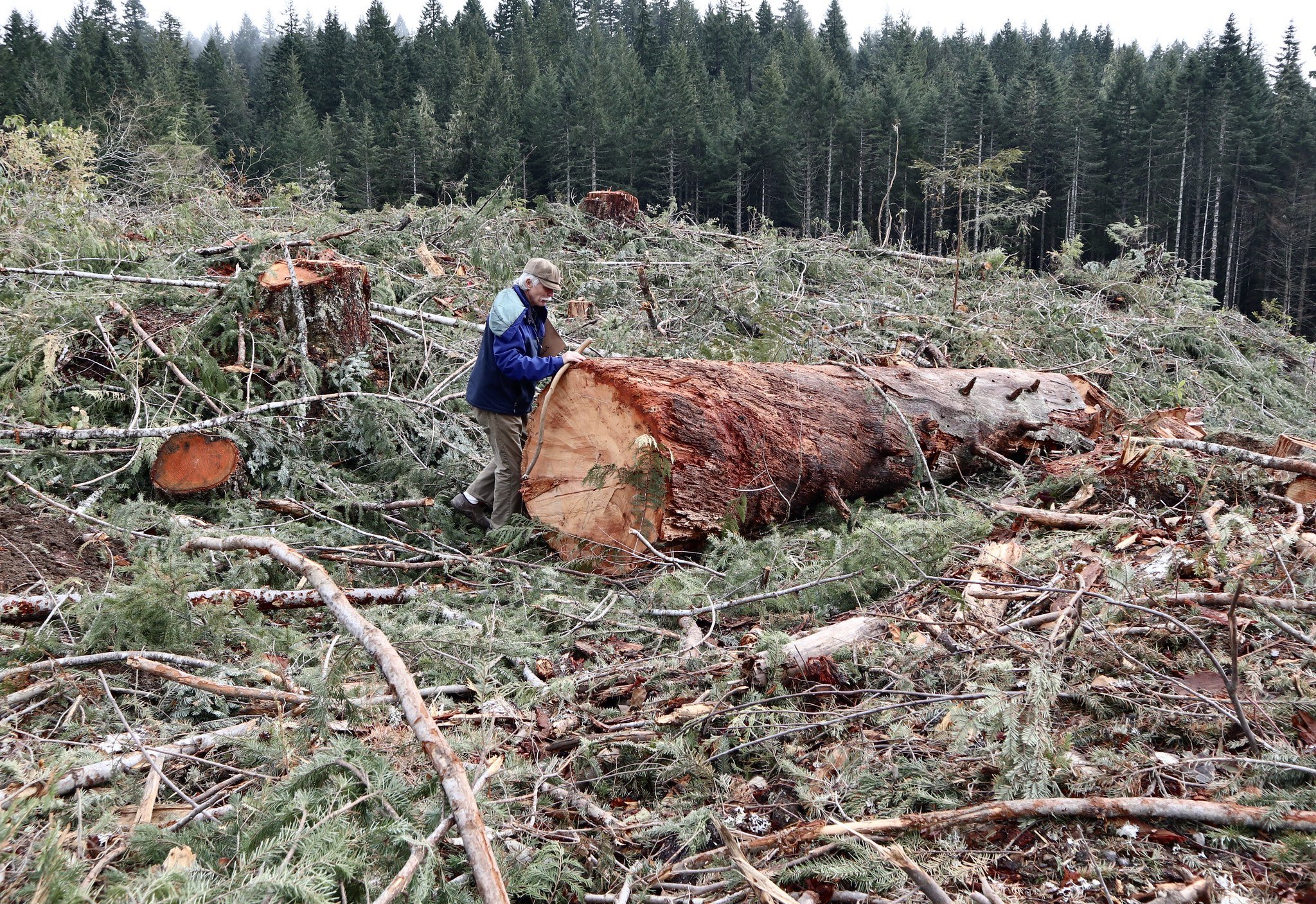
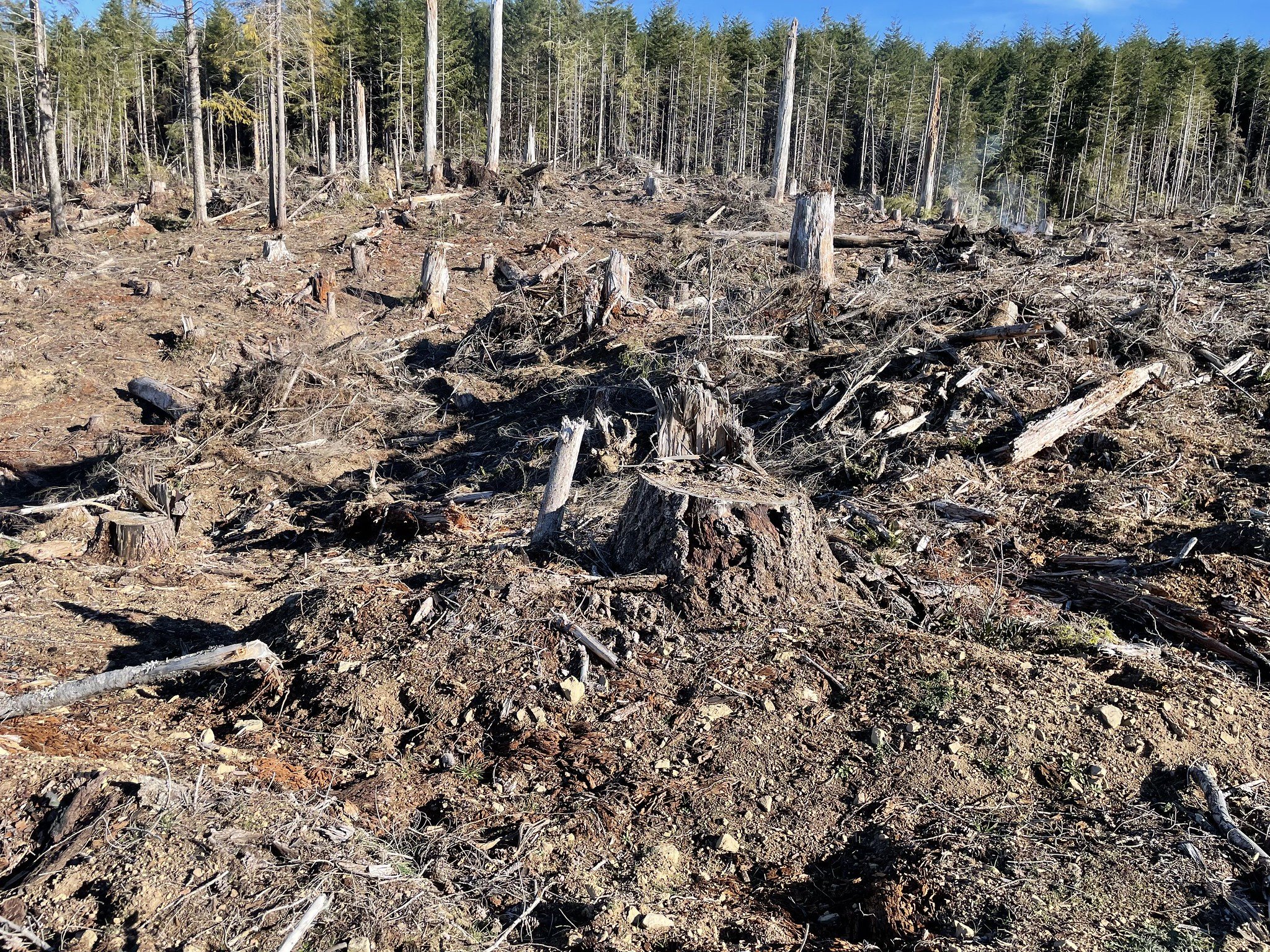
While the logging in these sales was promoted to the public as “thinning”, all too often the reality on the ground is heavy industrial-style logging that damages wildlife habitats, streams, water quality, soils, and ecological integrity.

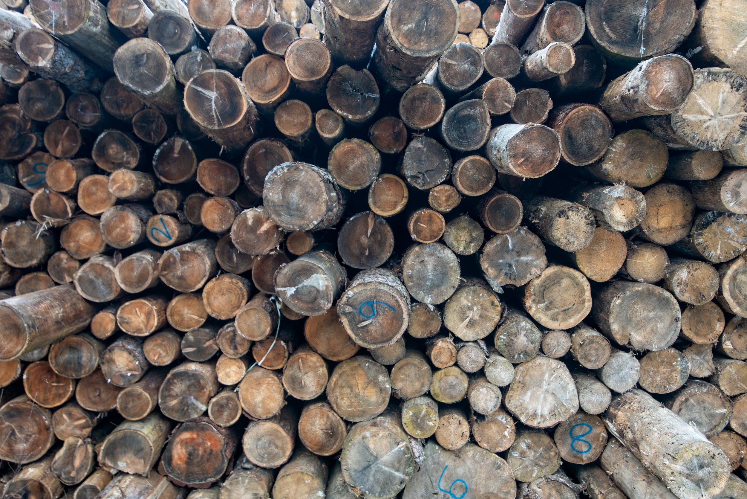
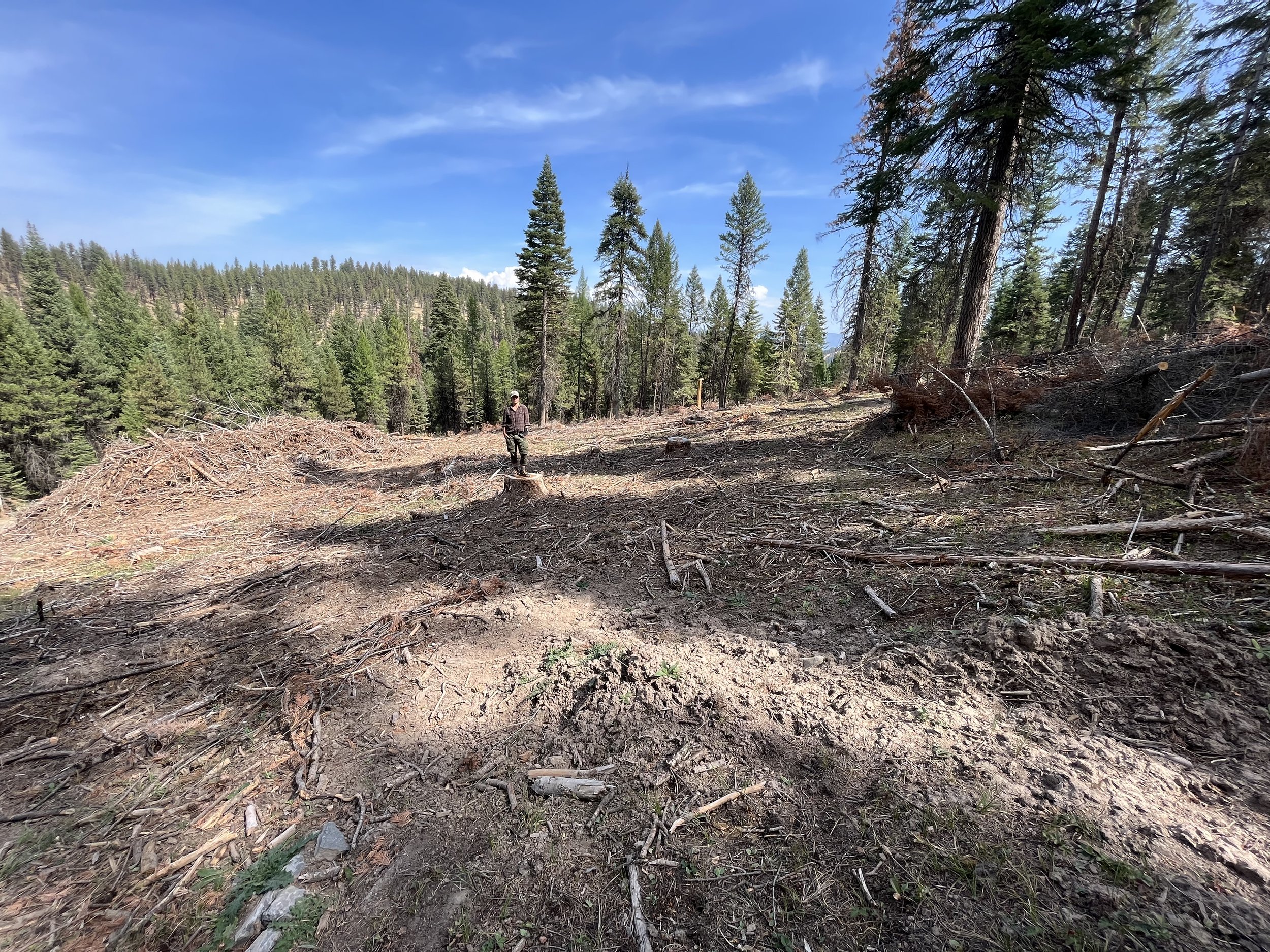
Deschutes National Forest (Oregon) - Lex "Vegetation Management" project (Credit: Blue Mountains Biodiversity Project 2021). Forest Service description: "Treat roughly 6,500 acres of lodgeopole and mixed conifer forests to restore historic species composition, structure, and process. Treatments would include fuels reduction and prescribed burning."
Deschutes National Forest (Oregon) - Lex "Vegetation Management" project (Credit: Blue Mountains Biodiversity Project 2021).

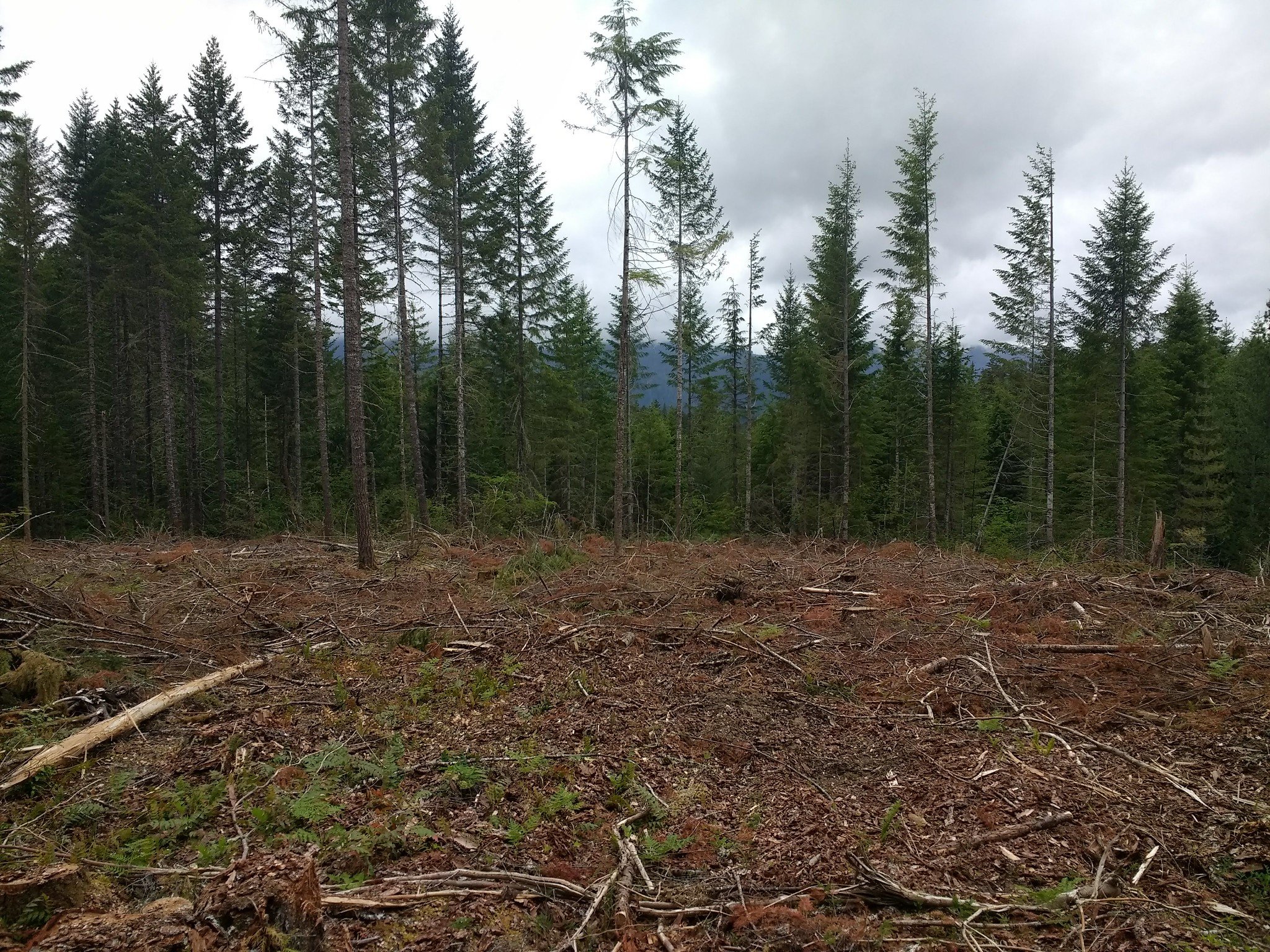
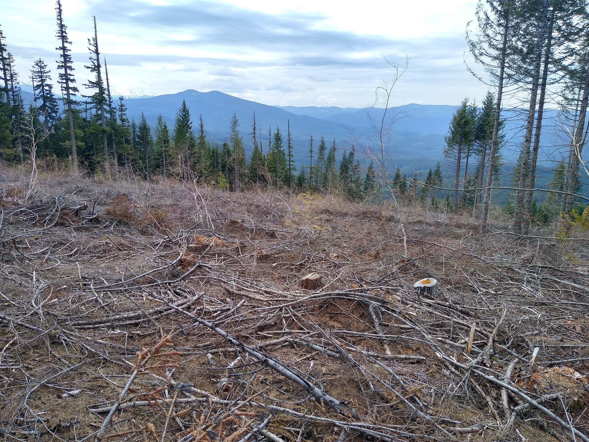
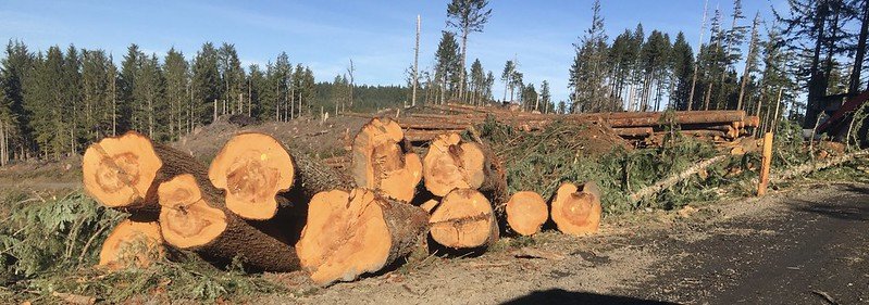
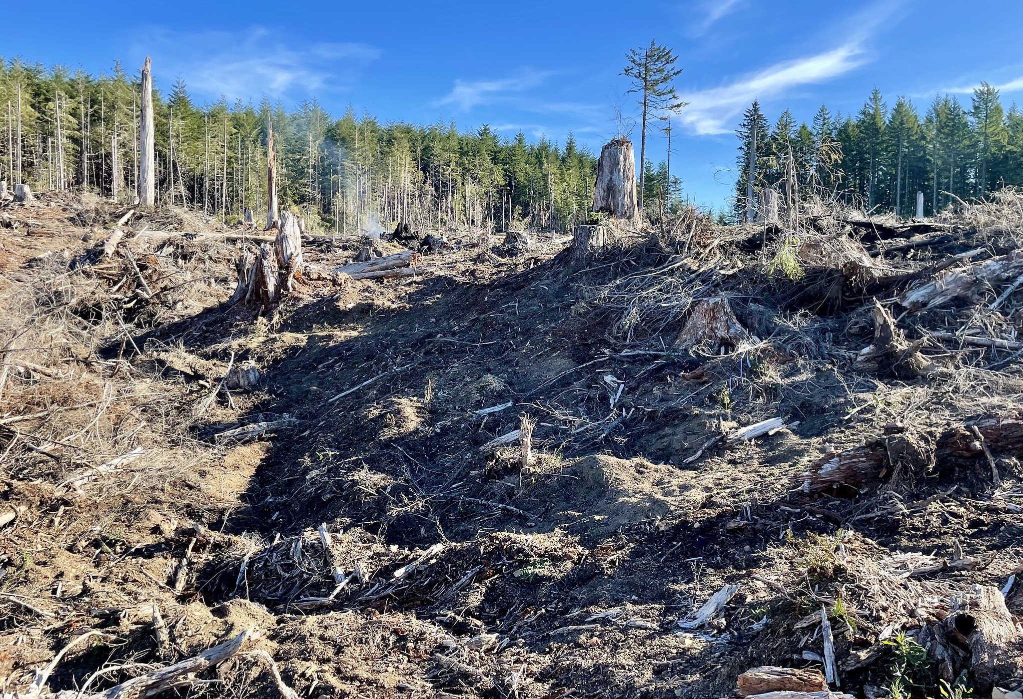
Fremont-Winema National Forest (Oregon) - fuels thinning (Credit: Oregon Wild)
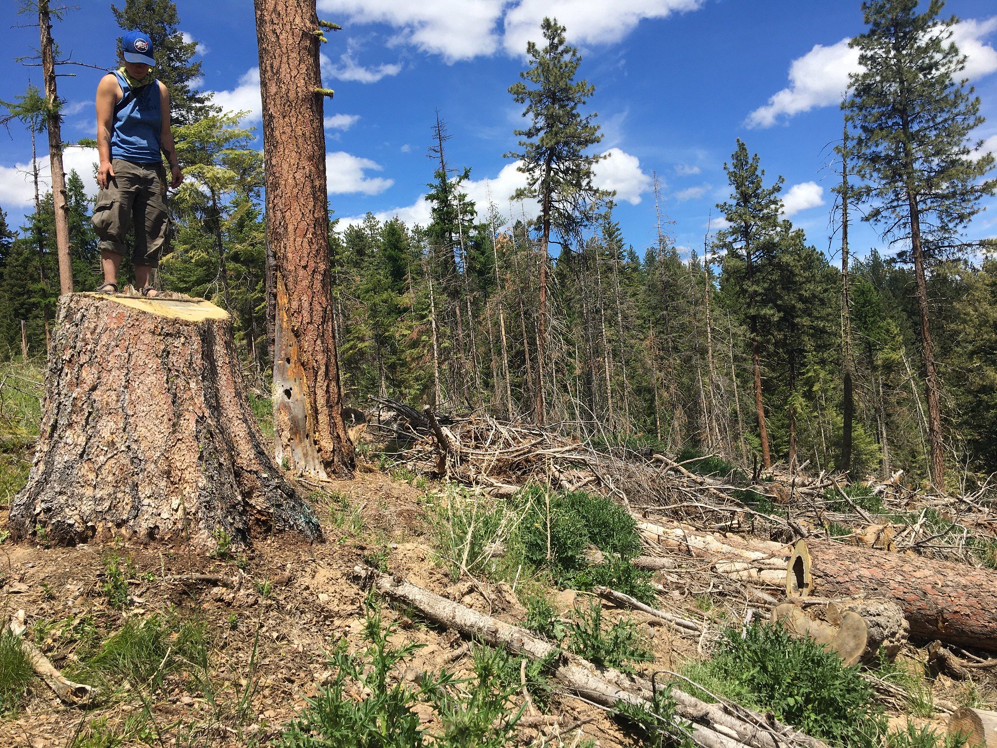
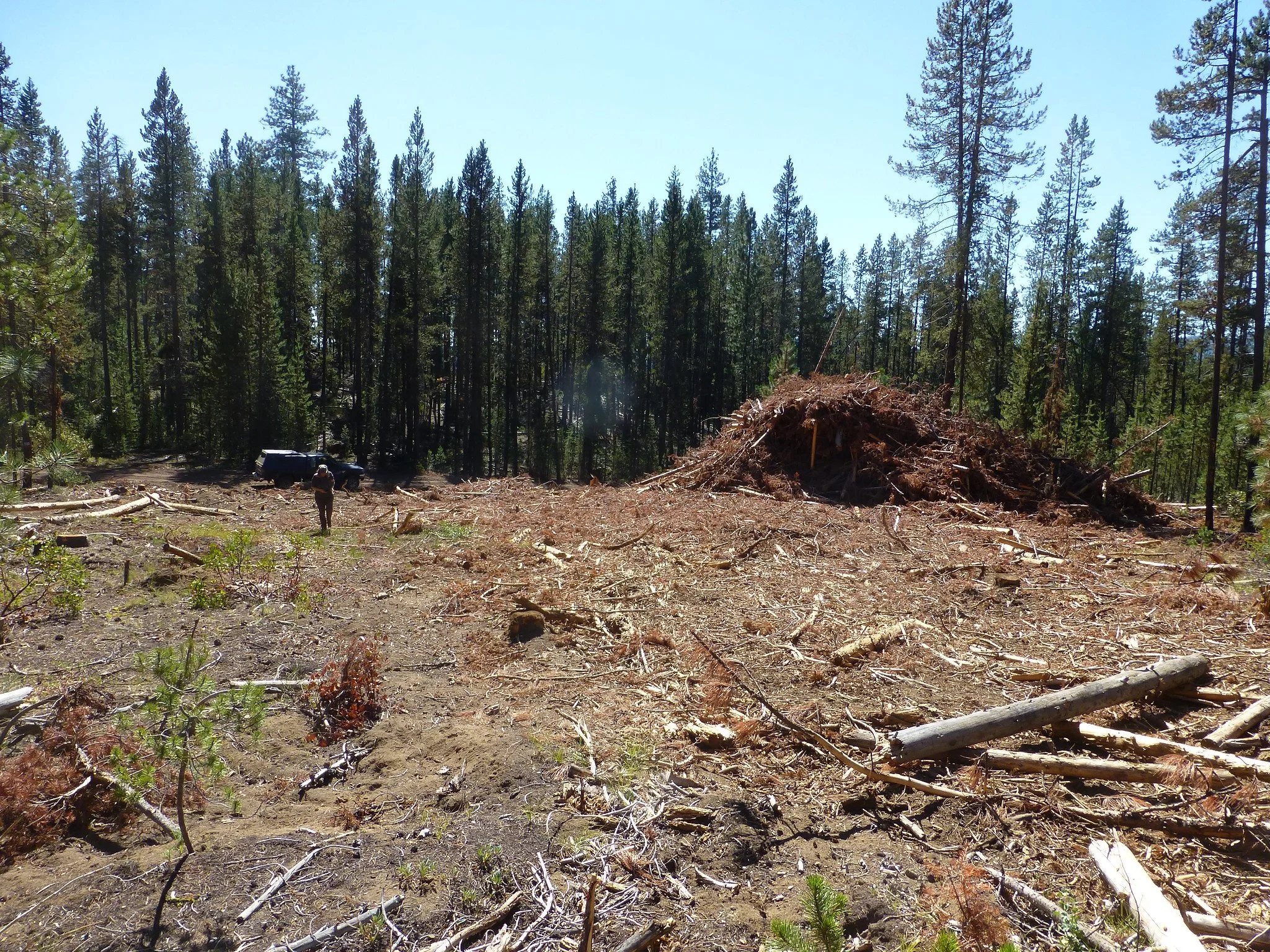
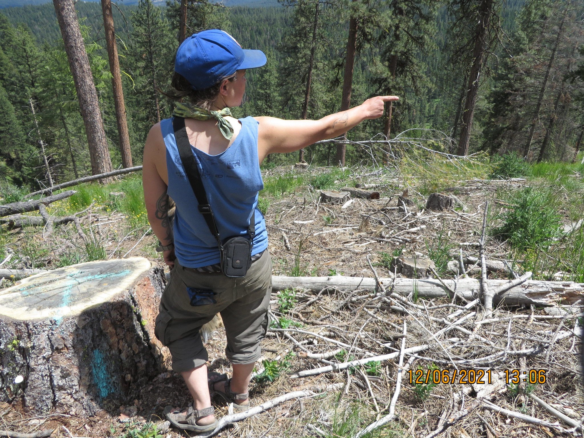
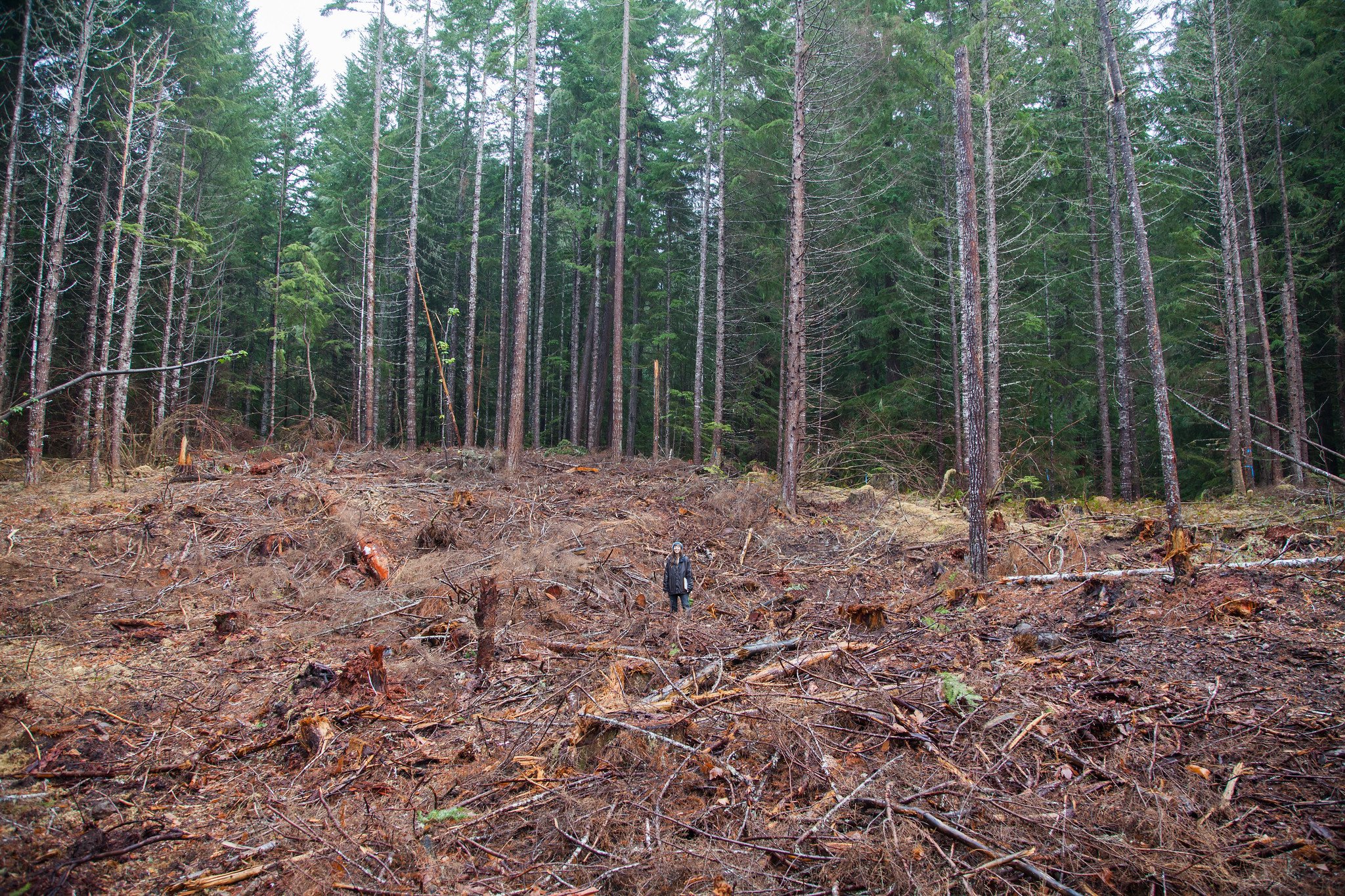
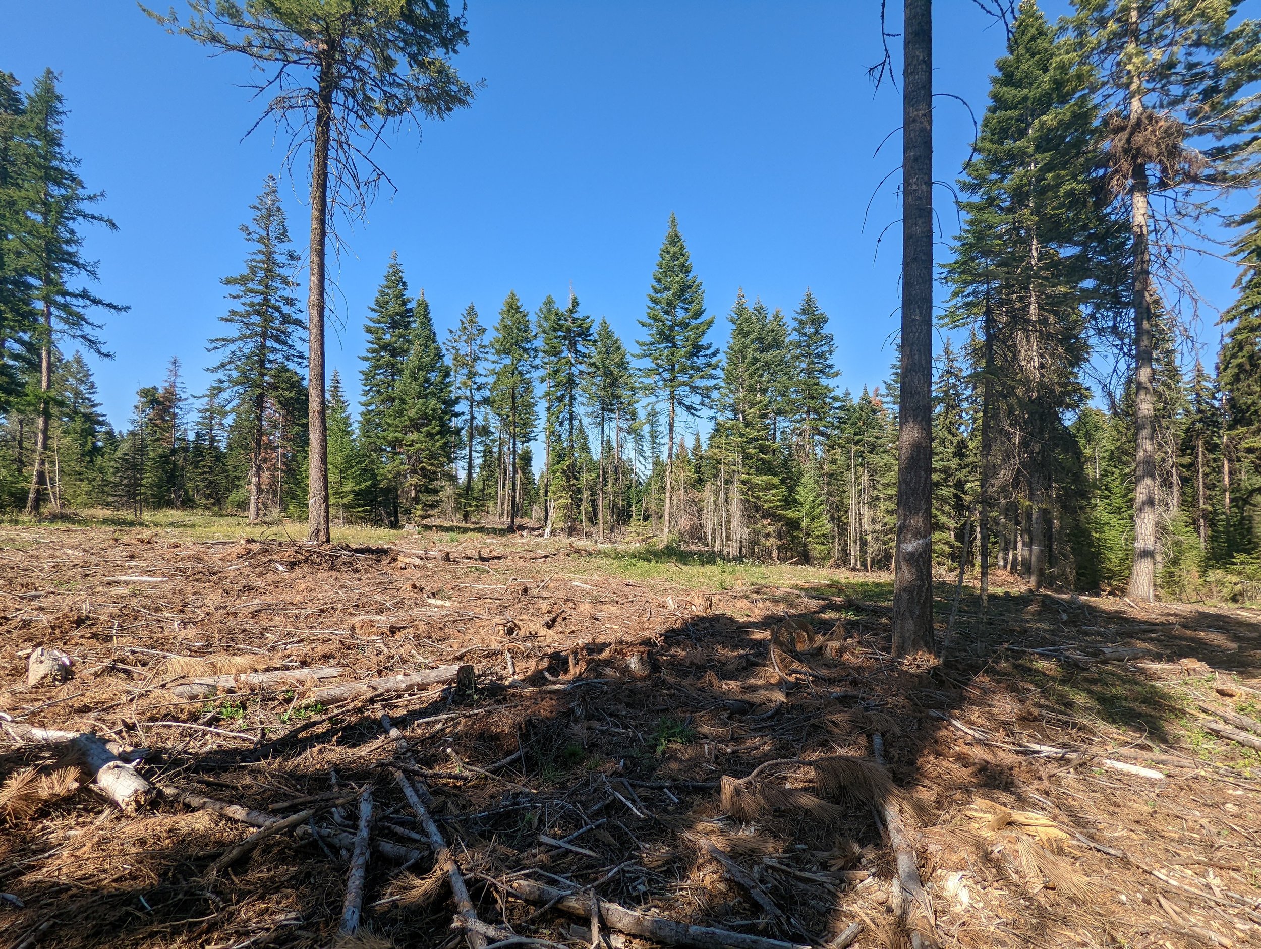
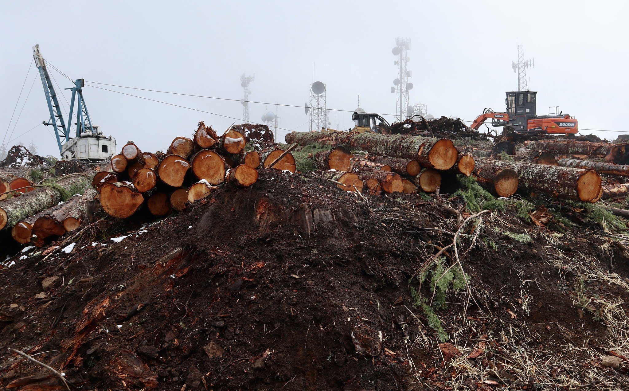
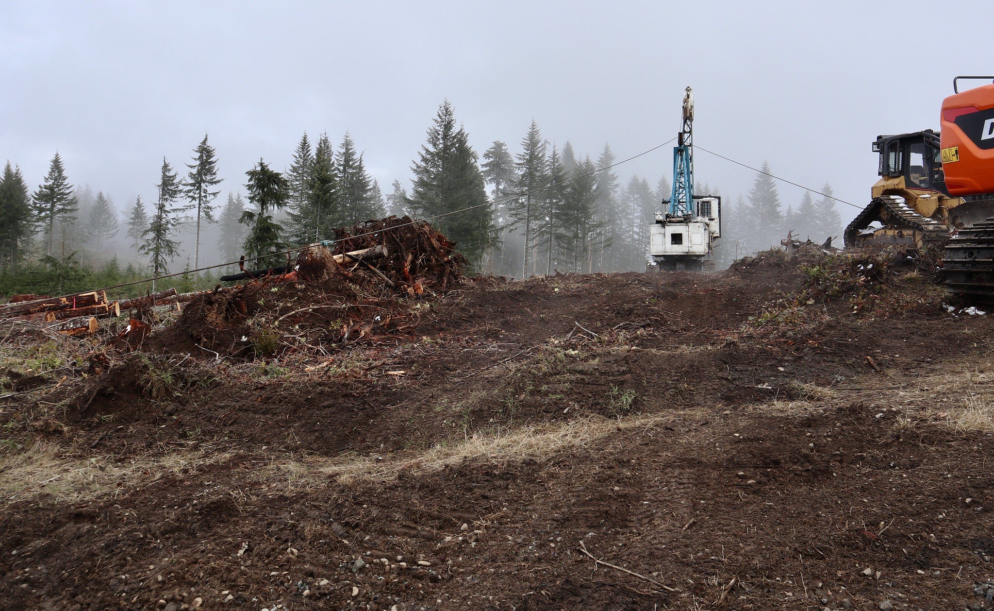
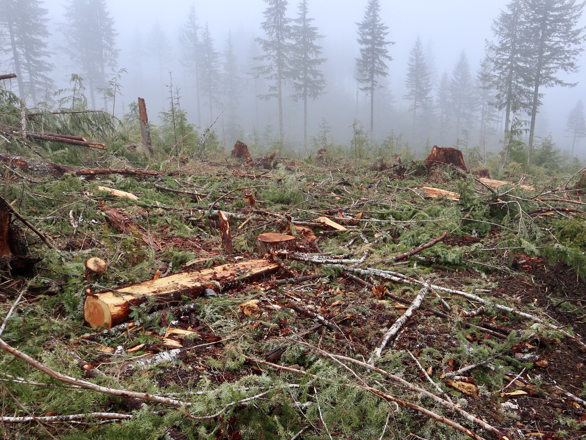
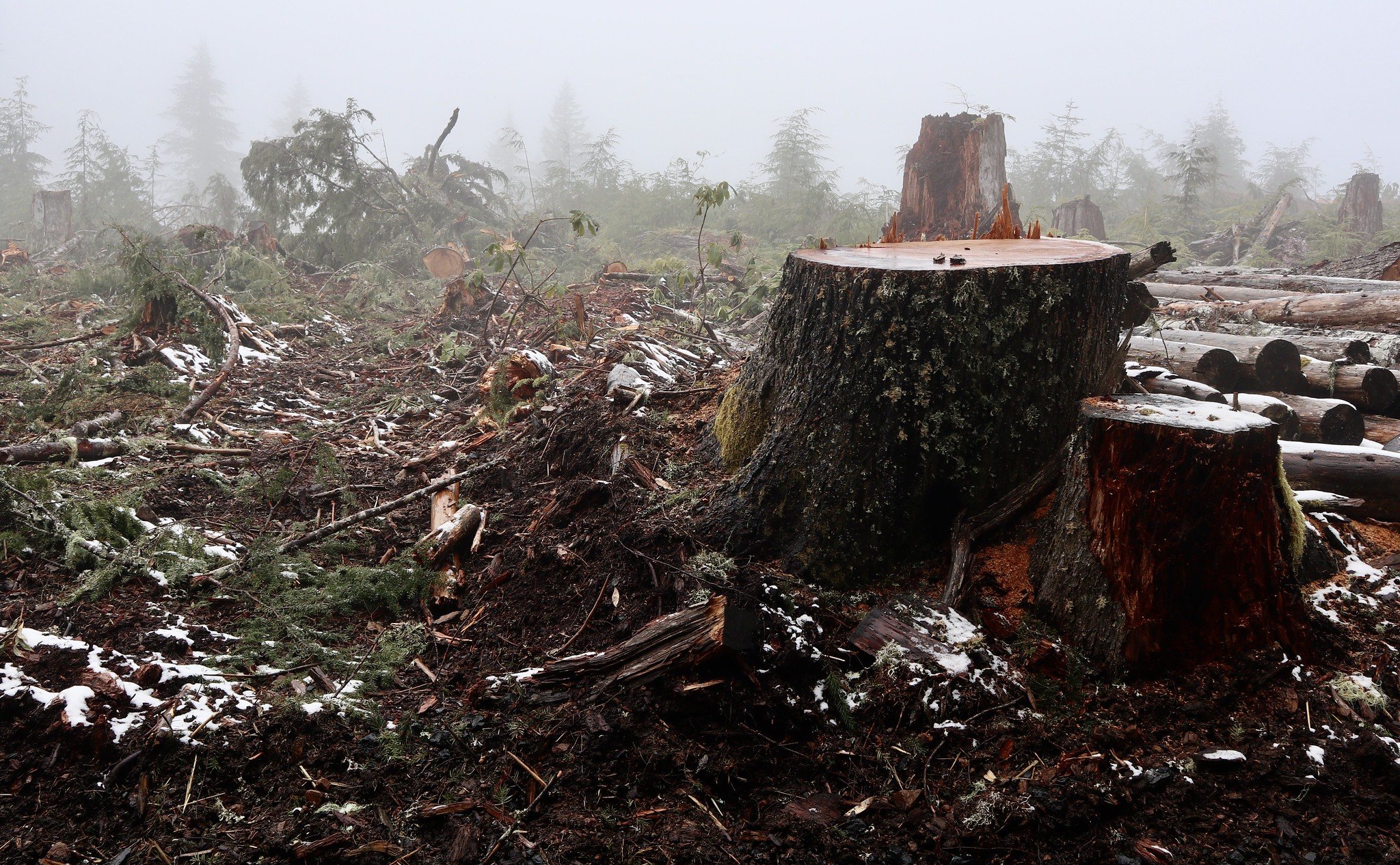
Malheur National Forest (Oregon) - Big Mosquito sale - "Free selection" thinning (Credit: Blue Mountains Biodiversity Project 2021). The Forest Service's description of this sale says that activities will "restore forest resiliency."
Malheur National Forest (Oregon) - Big Mosquito sale - "Free selection" thinning (Credit: Blue Mountains Biodiversity Project 2021)
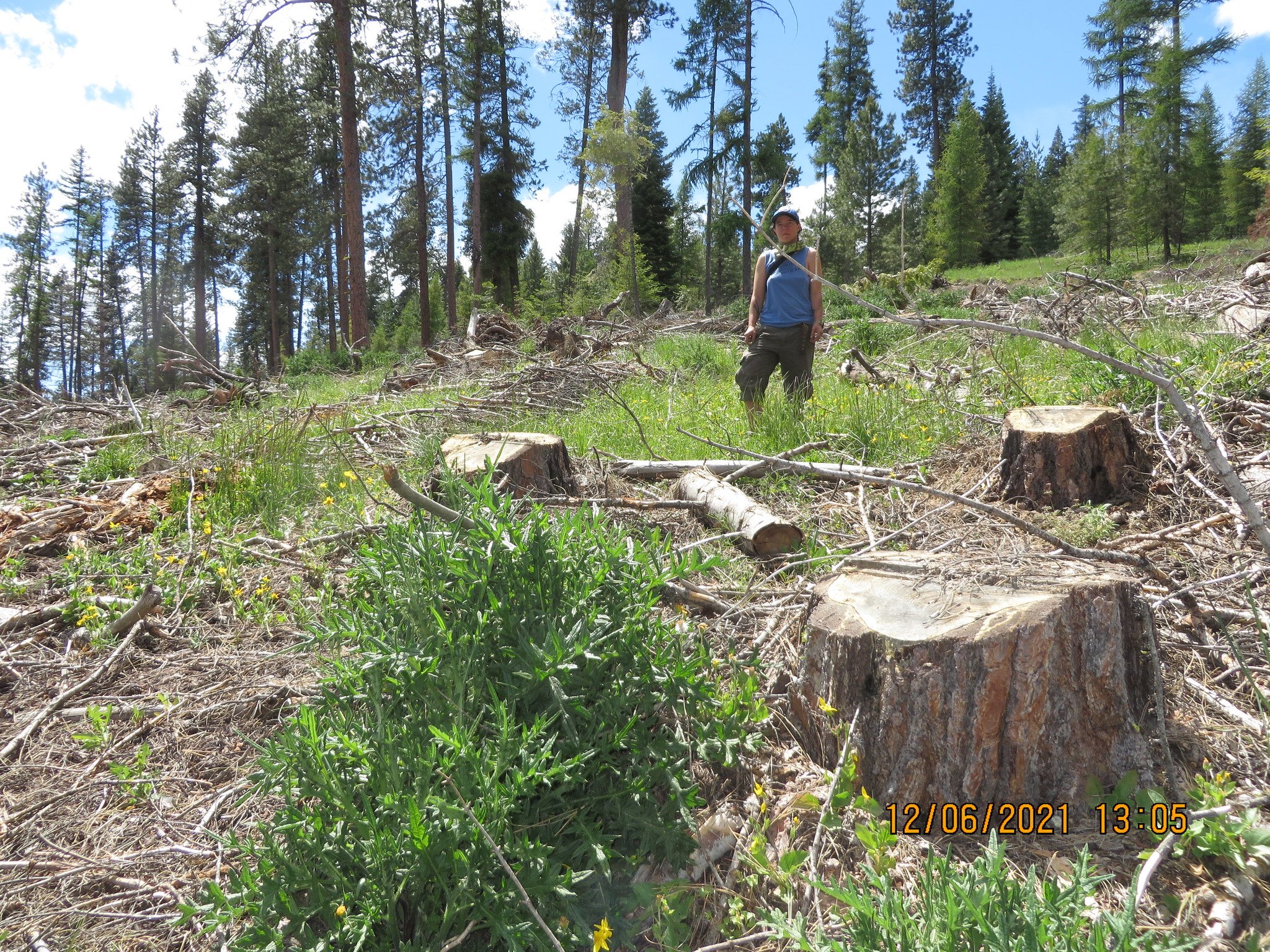
Malheur National Forest (Oregon) - Big Mosquito sale - "Free selection" thinning (Credit: Blue Mountains Biodiversity Project 2021)
Malheur National Forest (Oregon) - Big Mosquito sale - "Free selection" thinning (Credit: Blue Mountains Biodiversity Project 2021)

Malheur National Forest (Oregon) - Big Mosquito sale - "Free selection" thinning (Credit: Blue Mountains Biodiversity Project 2021)

Malheur National Forest (Oregon) - Big Mosquito sale - "Free selection" thinning (Credit: Blue Mountains Biodiversity Project 2021)
Malheur National Forest (Oregon) - Big Mosquito sale - "Free selection" thinning (Credit: Blue Mountains Biodiversity Project 2021)
Malheur National Forest (Oregon) - Big Mosquito sale - "Free selection" thinning (Credit: Blue Mountains Biodiversity Project 2021)

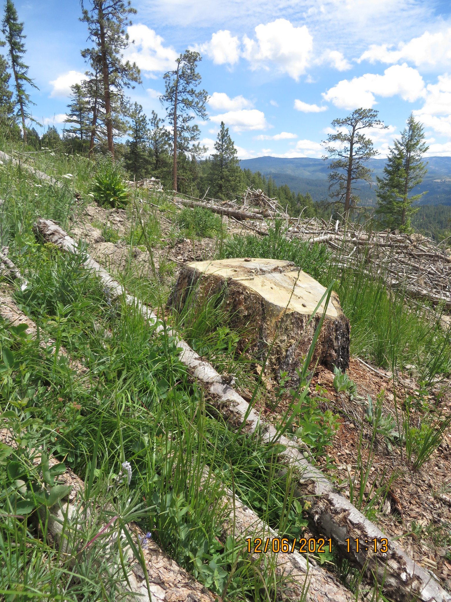
Malheur National Forest (Oregon) - Camp Lick sale - "Stand Improvement Commercial Thinning" (Credit: Blue Mountains Biodiversity Project 2021). The Forest Service's description of this sale says that activities will "restore forest resiliency."

Malheur National Forest (Oregon) - Camp Lick sale - "Stand Improvement Commercial Thinning" (Credit: Blue Mountains Biodiversity Project 2021)
Malheur National Forest (Oregon) - Camp Lick sale - "Stand Improvement Commercial Thinning" (Credit: Blue Mountains Biodiversity Project 2022)

Malheur National Forest (Oregon) - Camp Lick sale - "Stand Improvement Commercial Thinning" (Credit: Blue Mountains Biodiversity Project 2021)
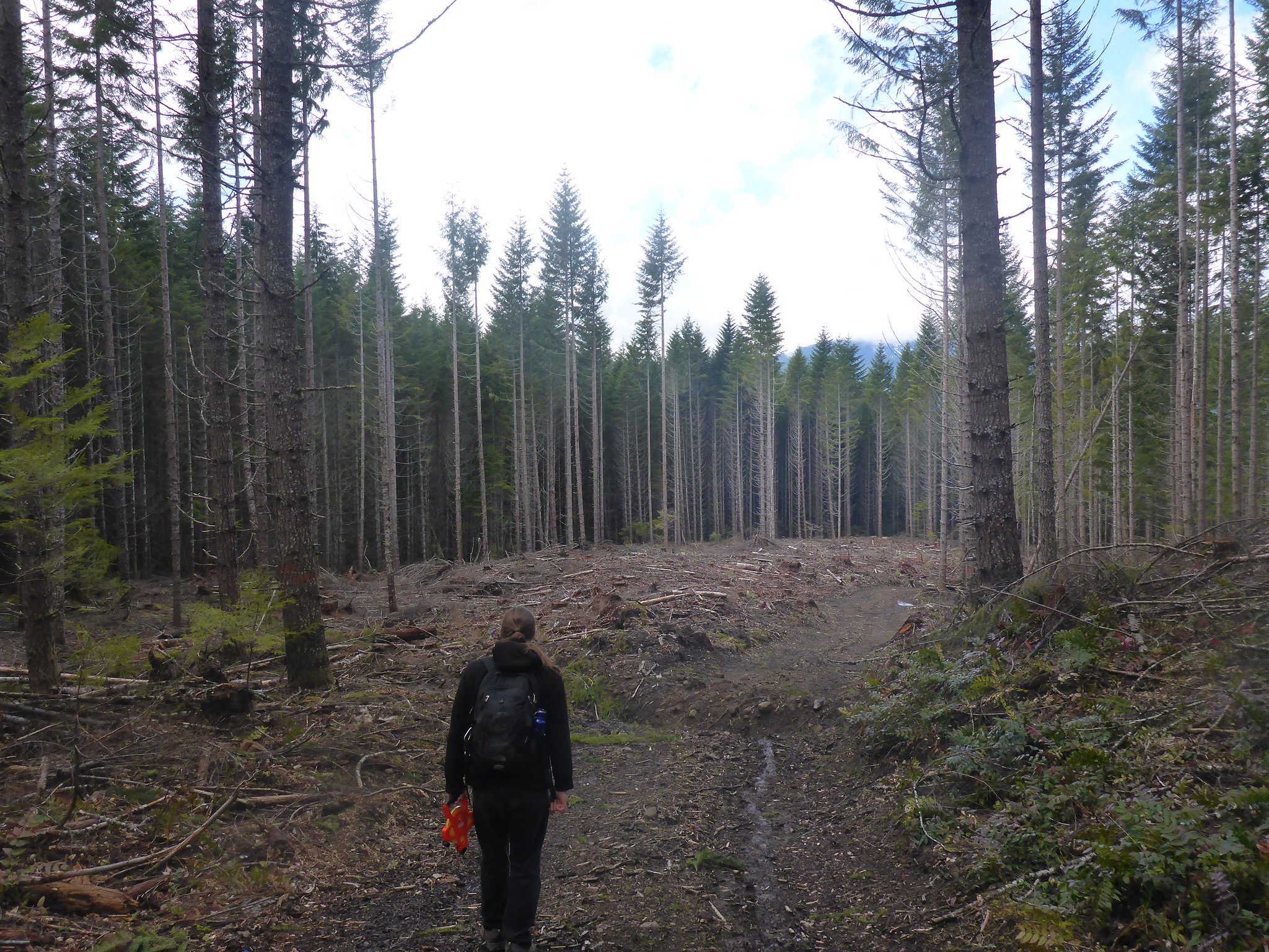
Mt. Hood National Forest (Oregon) - 2007 Thin sale (Credit: Bark 2014)
Mt. Hood National Forest (Oregon) - 2007 Thin sale - Slash pile (Credit: Bark 2013)
Mt. Hood National Forest (Oregon) - Bear Springs - Roadside slash (Credit: Bark 2017)
Mt. Hood National Forest (Oregon) - Grove "Thin" sale (Credit: Bark 2016)
Mt. Hood National Forest (Oregon) - Grove "Thin" sale (Credit: Bark 2016)

Mt. Hood National Forest (Oregon) - Grove "Thin" sale (Credit: Bark 2016)
Mt. Hood National Forest (Oregon) - Grove "Thin" sale (Credit: Bark 2016)

Mt. Hood National Forest (Oregon) - Grove "Thin" sale (Credit: Bark 2016)

Mt. Hood National Forest (Oregon) - Lava "Restoration" sale (Credit: Bark 2021)

Umpqua National Forest (Oregon) - Diamond Lake area (Credit: Oregon Wild)
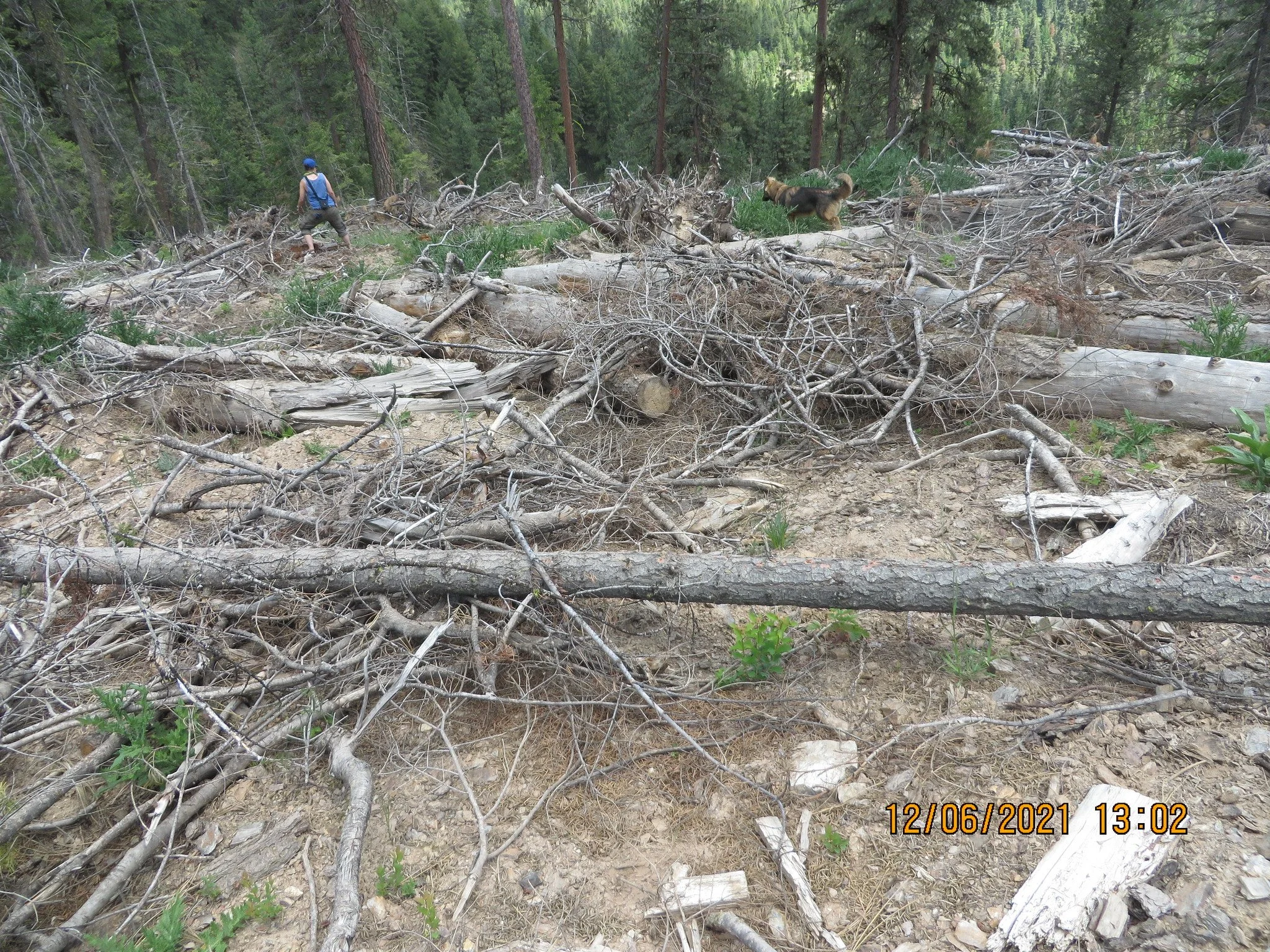
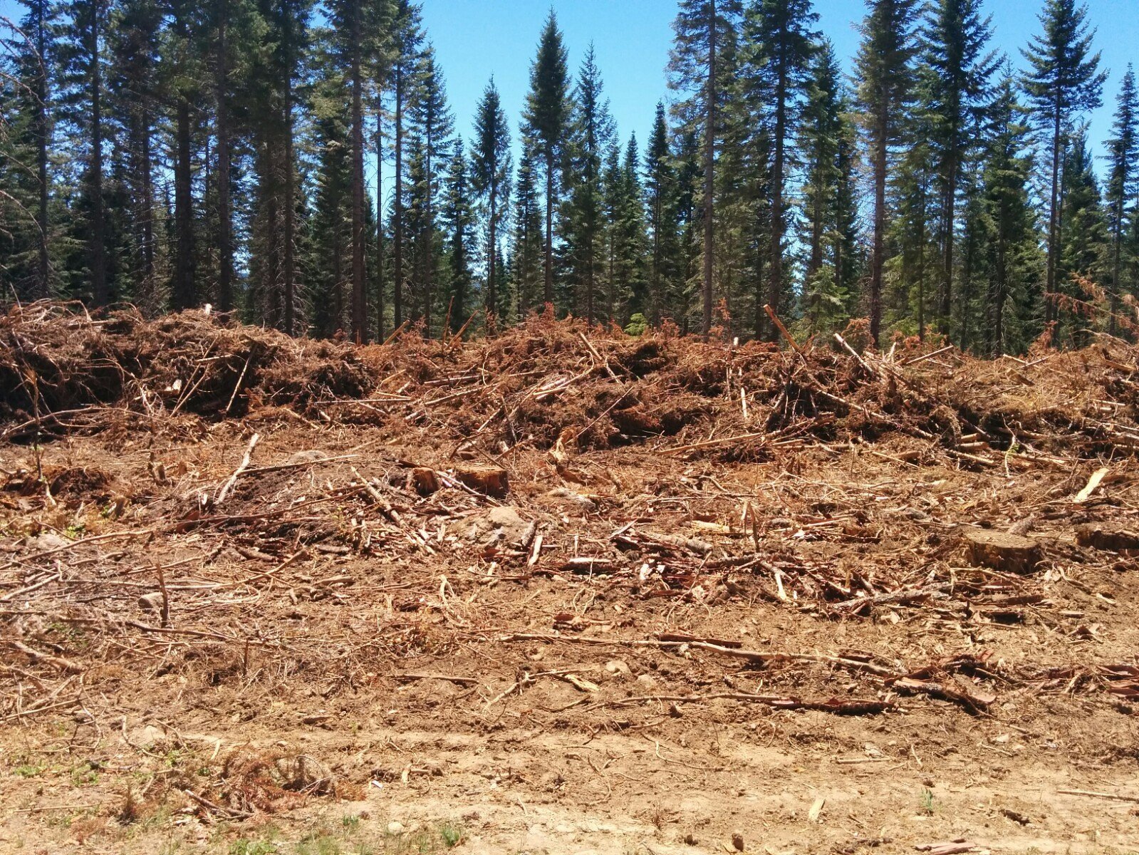
Not all logging on public lands includes old growth logging and clearcuts. However, even when large and old trees are not cut down, more often than not we see issues such as extensive soil damage, excessive roading, logging on steep slopes, erosion, and degradation or destruction of water quality and wildlife habitats.

Mt. Hood National Forest (Oregon) - Grove "Thin" sale - soil impacts (Credit: Bark)

Mt. Hood National Forest (Oregon) - Jazz "Thin" sale - "temporary" road (Credit: Bark).
Mt. Hood National Forest (Oregon) - 2007 Thin sale - "temporary" road (Credit: Bark)

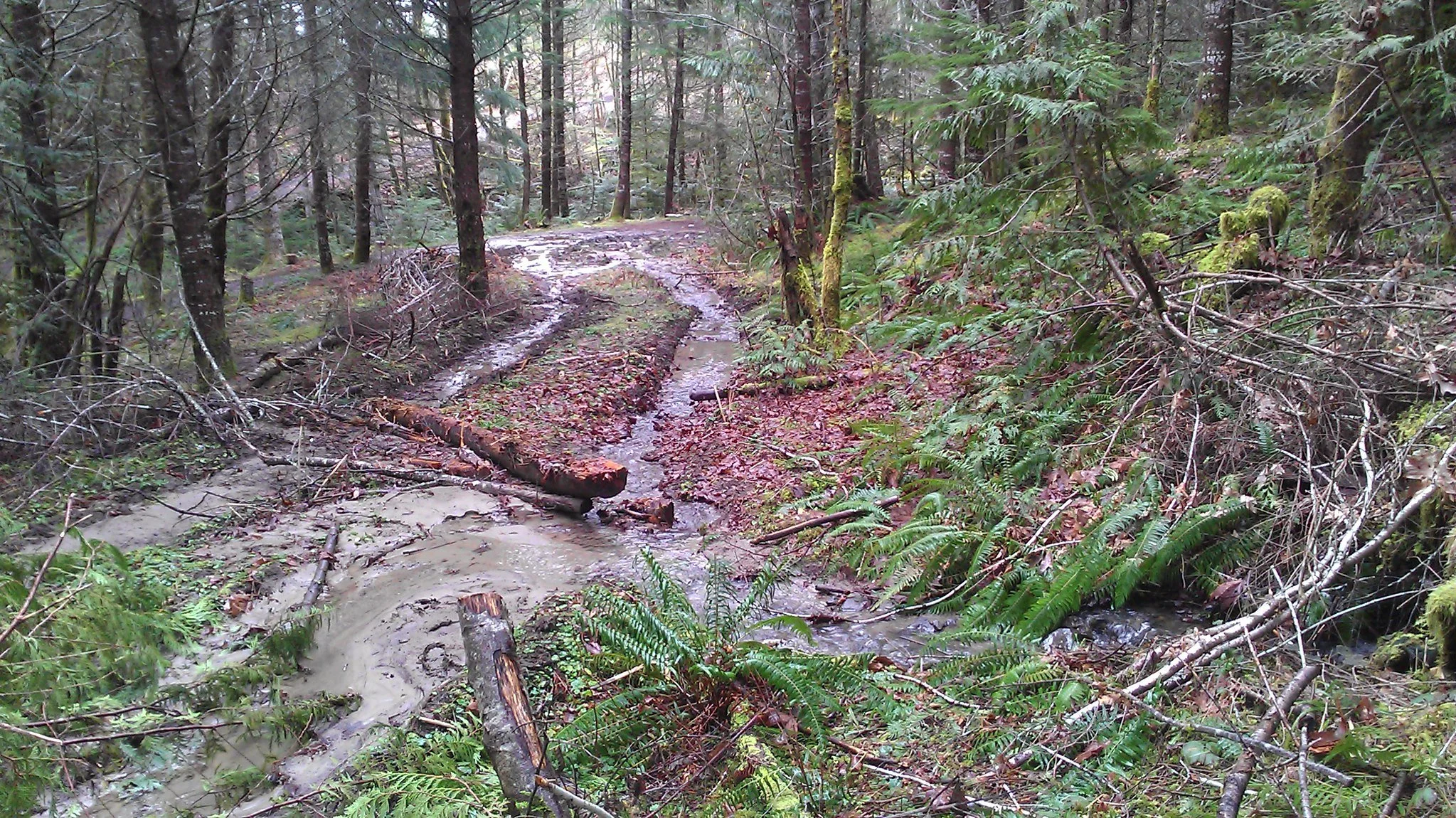
Mt. Hood National Forest (Oregon) - 2007 Thin - culvert failure (Credit: Bark)

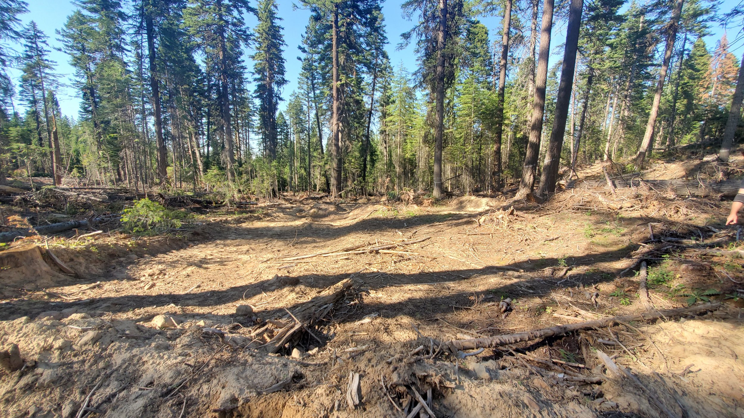
Malheur National Forest (Oregon) - Big Mosquito sale - soil damage (Credit: Blue Mountains Biodiversity Project).
Logging on public lands isn’t limited to National Forests and Bureau of Land Management lands. Here’s a few examples of logging in Yosemite National Park:

Yosemite National Park (California) - "thinning" in Yosemite Valley (Credit: John Muir Project 2022)

Yosemite National Park (California) - "thinning" in Yosemite Valley (Credit: John Muir Project 2022)

Yosemite National Park (California) - "thinning" in Yosemite Valley (Credit: John Muir Project 2022)

Yosemite National Park (California) - "thinning" in Yosemite Valley (Credit: John Muir Project 2022)
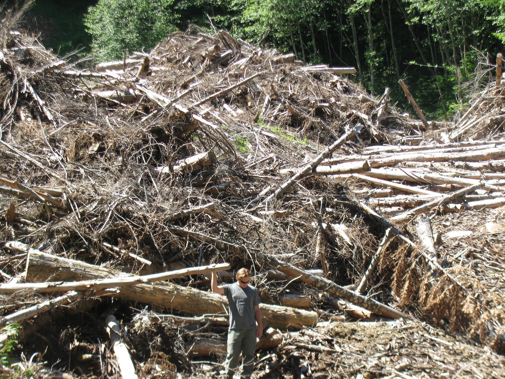
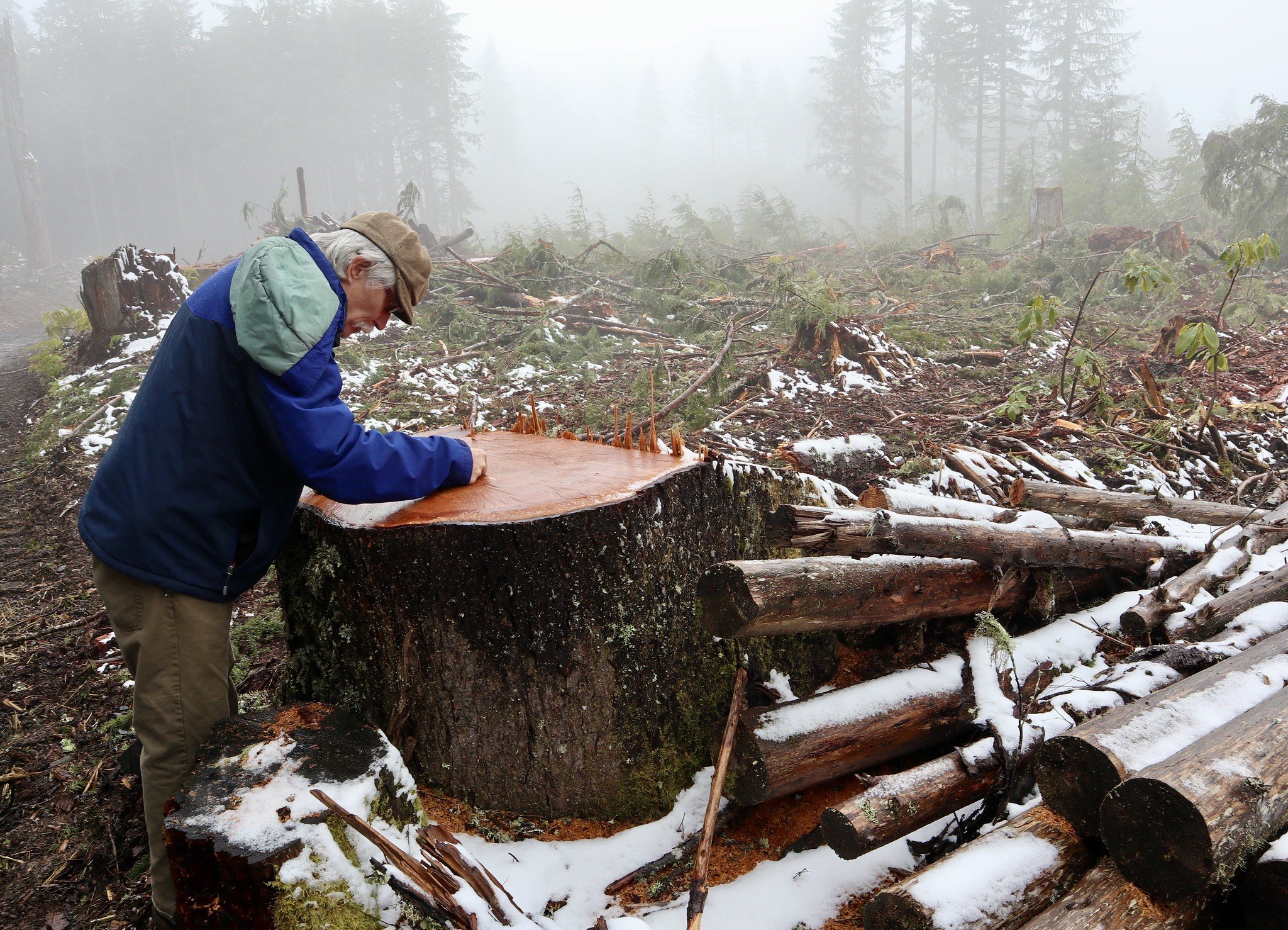
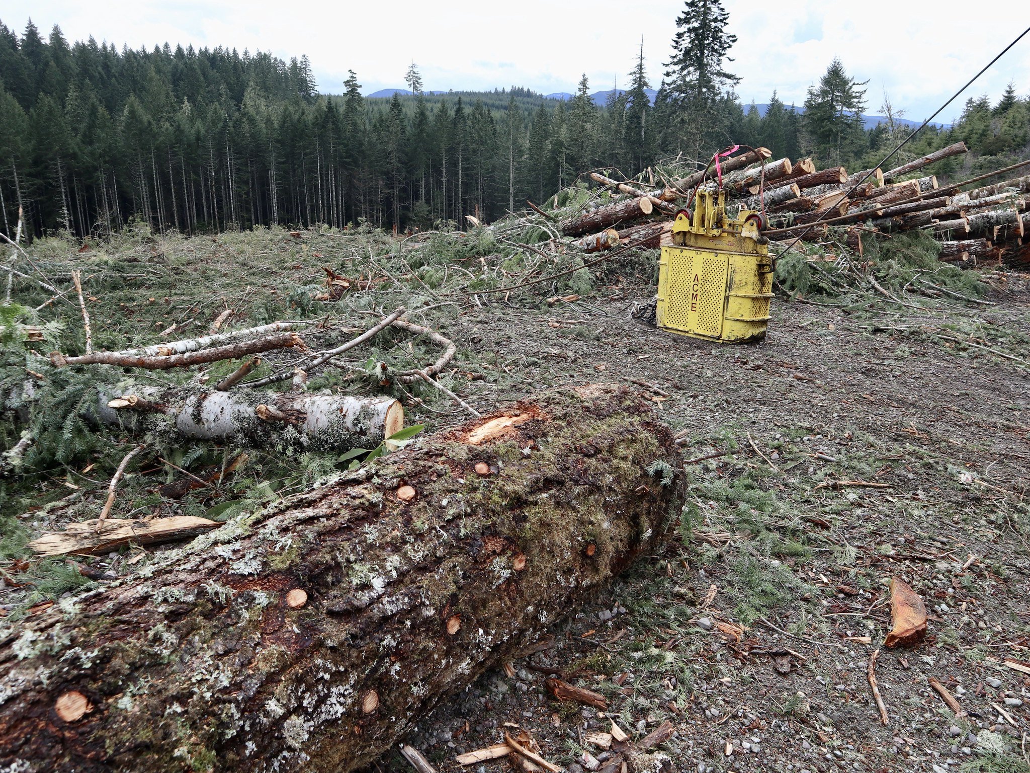
Photos of clearcuts and other industrial logging on public lands
Clearcuts and other intensive industrial logging projects are usually characterized by agencies as restoration and/or as public safety projects. Recently clearcut forests often grow back with thick brush and dense saplings, creating more of a potential fire hazard than the agency started with. The probability that a recently logged area will encounter a wildfire in the narrow window of time before it begins to grow back is very small, making such strategies ineffective as well as ecologically damaging.

Fremont-Winema National Forest (Oregon) (Credit: Oregon Wild)

Mt. Hood National Forest (Oregon)- Lemiti "Fuels Reduction Project" sale - "Regeneration" logging (Credit: Bark)
Mt. Hood National Forest (Oregon) - Hunter "Integrated Resource Project" sale - "Regeneration" logging (Credit: Bark 2021)

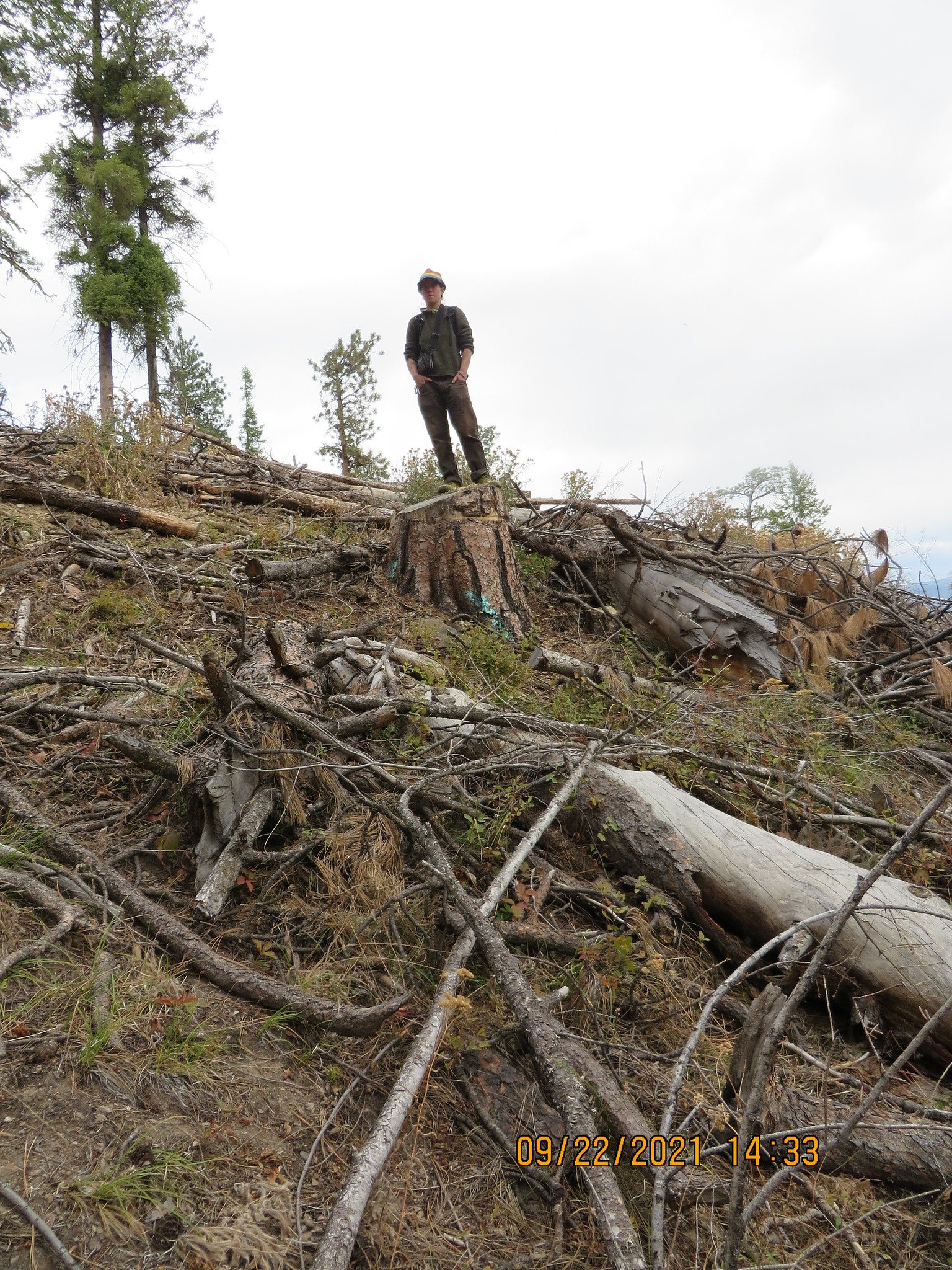
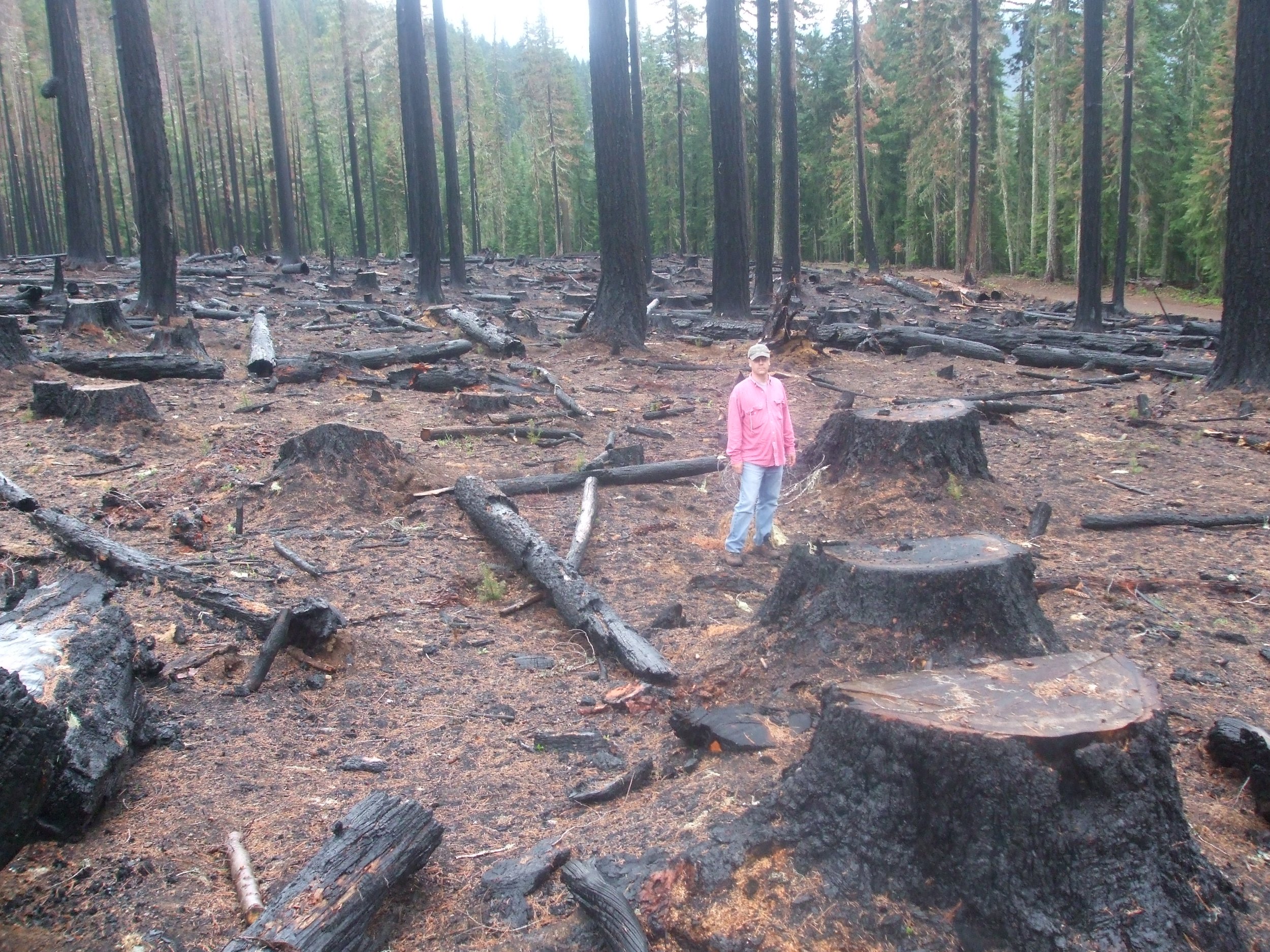
Nez Perce National Forest (Idaho) - Orogrande "Community Protection Project" - "Shelterwood" logging (Credit: Friends of the Clearwater)

Nez Perce National Forest (Idaho) - Orogrande "Community Protection Project" - Logging followed by prescribed burning in the West Fork Crooked River Inventoried Roadless Area (Credit: Friends of the Clearwater 2019)

Nez Perce National Forest (Idaho) - Orogrande "Community Protection Project" - Logging followed by prescribed burning in the West Fork Crooked River Inventoried Roadless Area (Credit: Friends of the Clearwater 2019)

Nez Perce National Forest (Idaho) - Orogrande "Community Protection Project" - Logging followed by prescribed burning in the West Fork Crooked River Inventoried Roadless Area (Credit: Friends of the Clearwater 2019)

Nez Perce National Forest (Idaho) - Orogrande "Community Protection Project" - Logging followed by prescribed burning in the West Fork Crooked River Inventoried Roadless Area (Credit: Friends of the Clearwater 2019)

Nez Perce National Forest (Idaho) - Orogrande "Community Protection Project" - Logging followed by prescribed burning in the West Fork Crooked River Inventoried Roadless Area (Credit: Friends of the Clearwater 2019)

Nez Perce National Forest (Idaho) - Orogrande "Community Protection Project" - Logging followed by prescribed burning in the West Fork Crooked River Inventoried Roadless Area (Credit: Friends of the Clearwater 2021)

Nez Perce Clearwater National Forest (Idaho) - Orogrande "Community Protection Project" - Logging followed by prescribed burning in the West Fork Crooked River Inventoried Roadless Area (Friends of the Clearwater 2021)

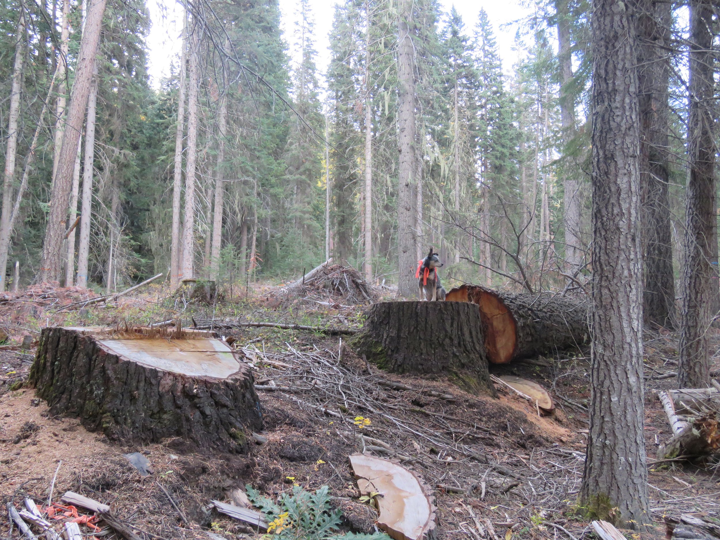
Nez Perce National Forest (Idaho) - Little Slate sale - "Seed tree with reserves" (Credit: Friends of the Clearwater)
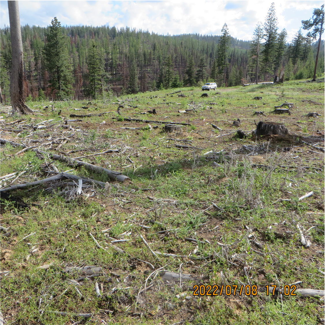
Umatilla National Forest (Washington) - South George "Vegetation and Fuels Management Project" (Credit: Blue Mountains Biodiversity Project 2022). Forest Service description of purpose of sale: "Vegetation management project to improve vigor, health, and fire resistence within a forested ecosystem"

Umatilla National Forest (Washington) - South George "Vegetation and Fuels Management Project" (Credit: Blue Mountains Biodiversity Project 2022)

Umatilla National Forest (Washington) - South George "Vegetation and Fuels Management Project" (Credit: Blue Mountains Biodiversity Project 2022)
Umpqua National Forest (Oregon) (Credit: Oregon Wild)
Wallowa-Whitman National Forest (Oregon) - Lostine Corridor "Public Safety Project" (Credit: Oregon Wild)

Wallow-Whitman National Forest (Oregon) - Lower Joseph Creek "Restoration Project" (Credit: Oregon Wild 2022)
Wallow-Whitman National Forest (Oregon) - Lower Joseph Creek "Restoration Project" (Credit: Oregon Wild 2022)
Wallow-Whitman National Forest (Oregon) - Lower Joseph Creek "Restoration Project" (Credit: Oregon Wild 2022)
Wallowa-Whitman National Forest (Oregon) - Puderbaugh "Vegetation Management Project" (Credit: Oregon Wild)

Bureau of Land Management (Oregon) - Buck Rising sale (Credit: Oregon Wild)

Bureau of Land Management (Oregon) - Buck Rising sale - madrone trees cut (Credit: Oregon Wild

Bureau of Land Management (Oregon) - Buck Rising sale (Credit: Oregon Wild)

Bureau of Land Management (Oregon) - Buck Rising sale (Credit: Oregon Wild)

Bureau of Land Management (Oregon) - Lone Rock - right-of-way logging (Credit: Francis Eatherington 2018)

Bureau of Land Management (Oregon) - Lone Rock - right-of-way logging (Credit: Francis Eatherington 2018)

Bureau of Land Management (Oregon) - Lone Rock - right-of-way logging (Credit: Francis Eatherington 2018)

Bureau of Land Management (Oregon) - Lone Rock - right-of-way logging (Credit: Francis Eatherington 2018)
Bureau of Land Management (Oregon) - Nails Creek sale - "Regeneration" logging (Credit: Oregon Wild)
Bureau of Land Management (Oregon) - Nails Creek sale - "Regeneration" logging (Credit: Oregon Wild)

Bureau of Land Management (Oregon) - Nails Creek sale - "Regeneration" logging (Credit: Oregon Wild)

Bureau of Land Management (Oregon) - Nails Creek sale - "Regeneration" logging (Credit: Oregon Wild)

Bureau of Land Management (Oregon) - Nails Creek sale - "Regeneration" logging (Credit: Oregon Wild)
Bureau of Land Management (Oregon) - Nails Creek sale - "Regeneration" logging (Credit: Oregon Wild)

Bureau of Land Management (Oregon) - Nails Creek sale - "Regeneration" logging with leave tree (Credit: Oregon Wild)

Bureau of Land Management (Oregon) - Nails Creek sale - "Regeneration" logging (Credit: Oregon Wild)

Bureau of Land Management (Oregon) - Panther Creek sale (Credit: Oregon Wild)

Bureau of Land Management (Oregon) - Upper Rock Creek sale - Coos Bay District (Credit: Francis Eatherington 2020)

Bureau of Land Management (Oregon) - Upper Rock Creek sale - Coos Bay District (Credit: Francis Eatherington 2020)

Bureau of Land Management Oregon) - Upper Rock Creek sale - Coos Bay District (Credit: Francis Eatherington 2020)

Bureau of Land Management (Oregon) - Upper Rock Creek sale - Coos Bay District (Credit: Francis Eatherington 2020)
Bureau of Land Management (Oregon) - Upper Rock Creek sale - Coos Bay District (Credit: Francis Eatherington 2020)

Bureau of Land Management (Oregon) - Upper Rock Creek sale - Coos Bay District (Credit: Francis Eatherington 2020)

Bureau of Land Management (Oregon) - Upper Rock Creek sale - Coos Bay District (Credit: Francis Eatherington 2020)

Bureau of Land Management (Oregon) - Upper Rock Creek sale - Coos Bay District (Credit: Francis Eatherington 2020)

Bureau of Land Management (Oregon) - Upper Rock Creek sale - Coos Bay District (Credit: Francis Eatherington 2020)

Bureau of Land Management (Oregon) - Upper Rock Creek sale - Coos Bay District (Credit: Francis Eatherington 2020)
Bureau of Land Management (Oregon) - Upper Rock Creek sale - Coos Bay District (Credit: Francis Eatherington 2020)
Bureau of Land Management (Oregon) - Upper Rock Creek sale - Coos Bay District (Credit: Francis Eatherington 2020)

Bureau of Land Management (Oregon) - Upper Rock Creek sale - Coos Bay District (Credit: Francis Eatherington 2020)

Bureau of Land Management (Oregon) - Upper Rock Creek sale - Coos Bay District (Credit: Francis Eatherington 2020)
Bureau of Land Management (Oregon) - Upper Rock Creek sale - Coos Bay District (Credit: Francis Eatherington 2020)
Bureau of Land Management (Oregon) - Upper Rock Creek sale - Coos Bay District (Credit: Francis Eatherington 2020)
Bureau of Land Management (Oregon) - Upper Rock Creek sale - Coos Bay District (Credit: Francis Eatherington 2020)
Bureau of Land Management (Oregon) - Upper Rock Creek sale - Coos Bay District (Credit: Francis Eatherington 2020)

Bureau of Land Management (Oregon) - Upper Rock Creek sale - Coos Bay District (Credit: Francis Eatherington 2020)
Bureau of Land Management (Oregon) - Upper Rock Creek sale - Coos Bay District (Credit: Francis Eatherington 2020)
Bureau of Land Management (Oregon) - Upper Rock Creek sale - Coos Bay District (Credit: Francis Eatherington 2020)

Bureau of Land Management (Oregon) - Upper Rock Creek sale - Coos Bay District (Credit: Francis Eatherington 2020)
Bureau of Land Management (Oregon) - Upper Rock Creek sale - Coos Bay District (Credit: Francis Eatherington 2020)
Bureau of Land Management (Oregon) - Upper Rock Creek sale - Coos Bay District (Credit: Francis Eatherington 2022)

Bureau of Land Management (Oregon) - Upper Rock Creek sale - Coos Bay District (Credit: Francis Eatherington 2022)
Bureau of Land Management (Oregon) - Upper Rock Creek sale - Coos Bay District (Credit: Francis Eatherington 2022)
Bureau of Land Management (Oregon) - Upper Rock Creek sale - Coos Bay District (Credit: Francis Eatherington 2022)
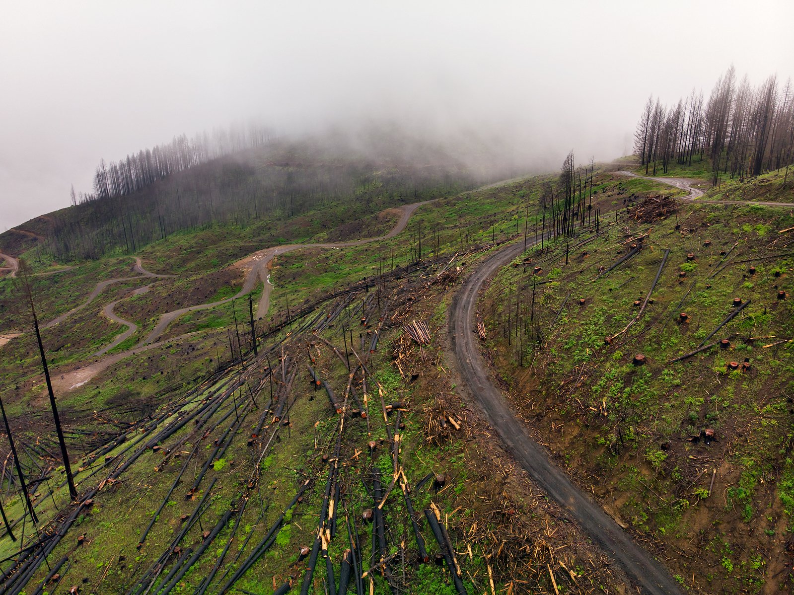
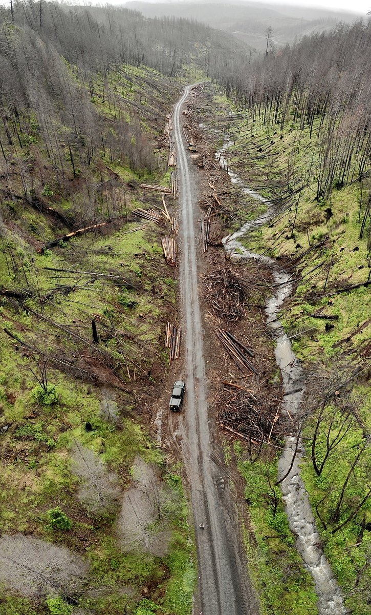
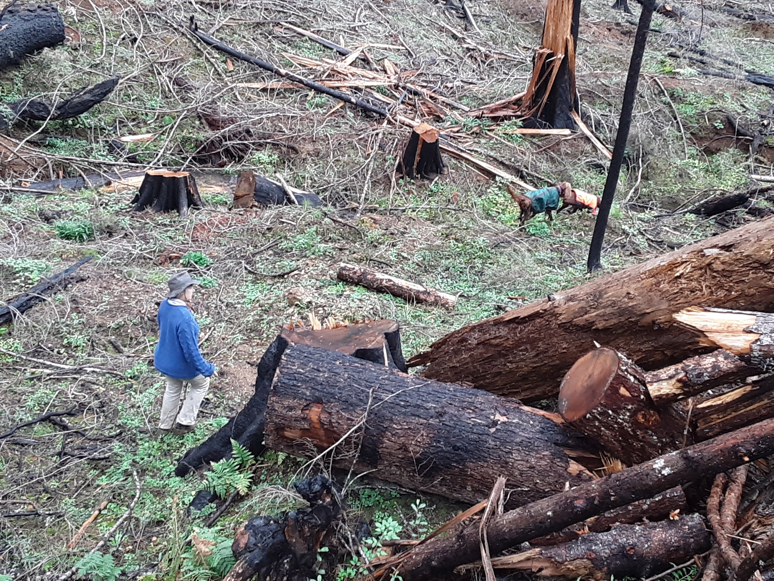
Examples of post-fire and “hazard” tree on public lands:
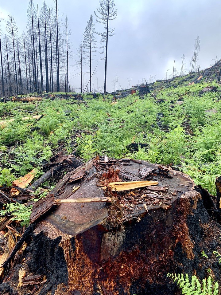
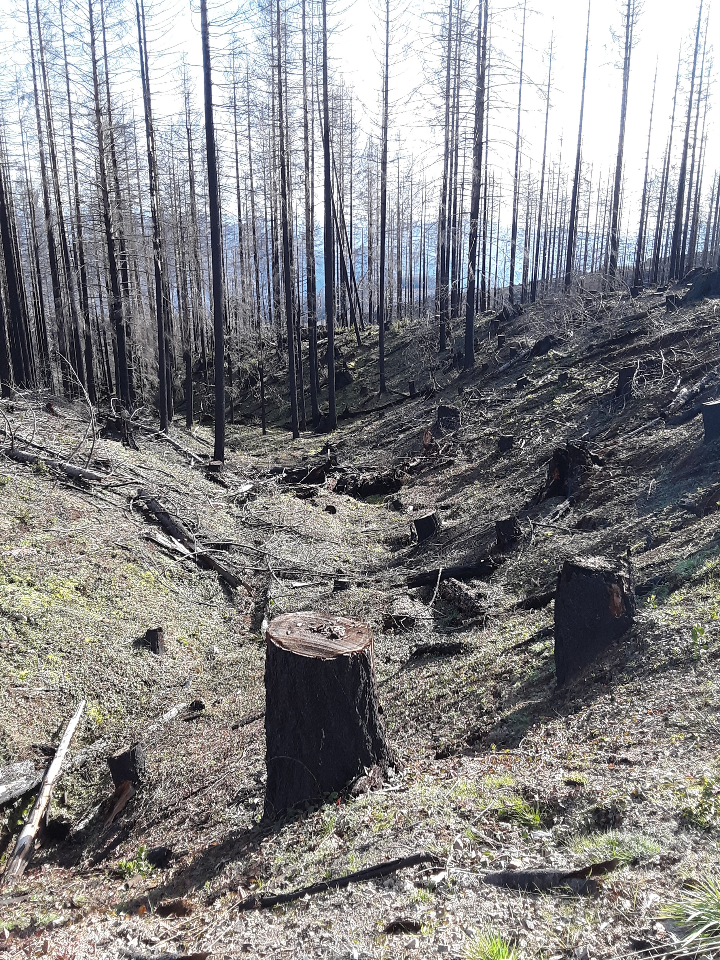
Forests in the Western US evolved with and rely on fire. Wildfires, including high-severity wildfires, are a necessary part of forest ecosystems. Many birds, fish, and wildlife species in the region rely on habitats that are born from and inextricably tied to wildfire. Post-fire “snag” forests support unique and important habitat to numerous species, and are a key step in the dynamic creation of forests at many stages of succession. Snag forests are an essential part of the landscape, but are unfortunately targeted for logging all too often on public lands— often with even less protection or public transparency.

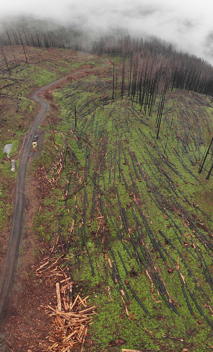
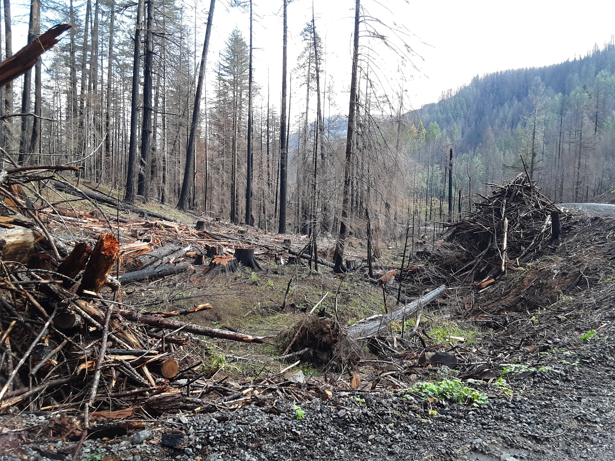
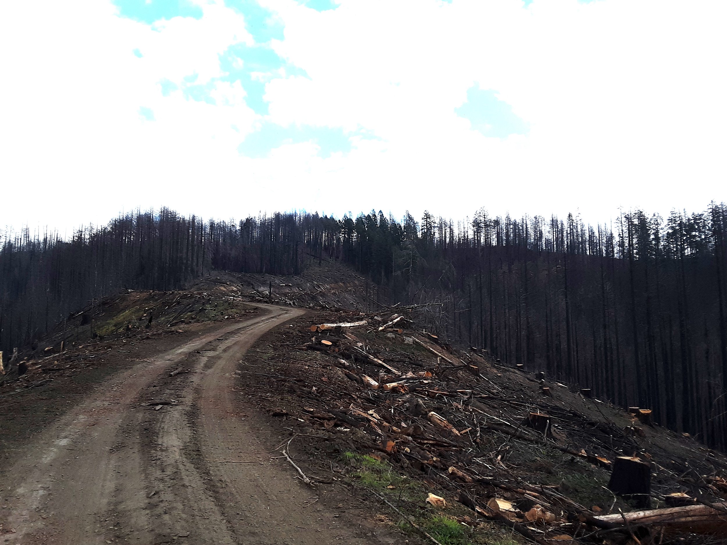
Deschutes National Forest (Oregon) - post-fire logging (Credit: Oregon Wild)

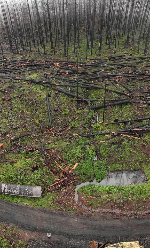
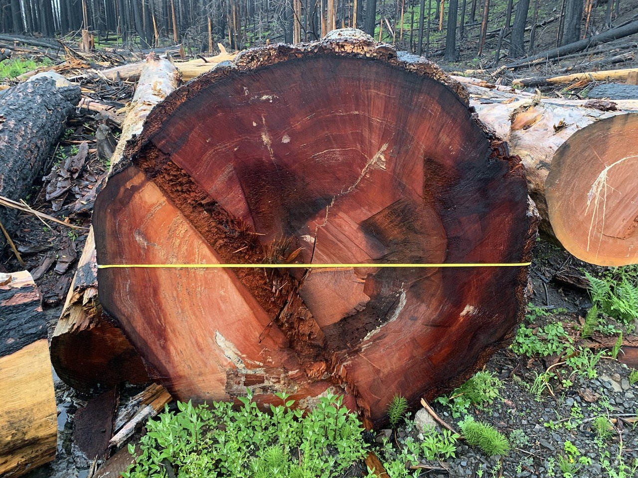
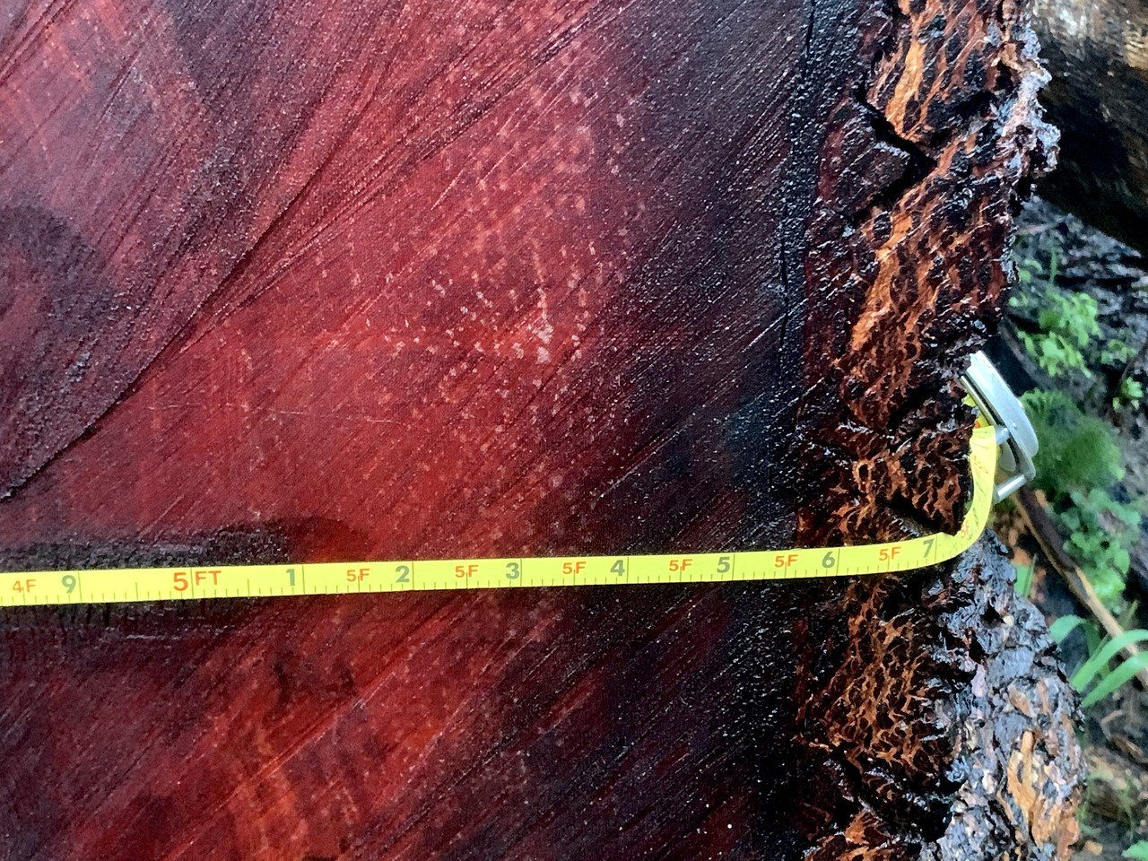
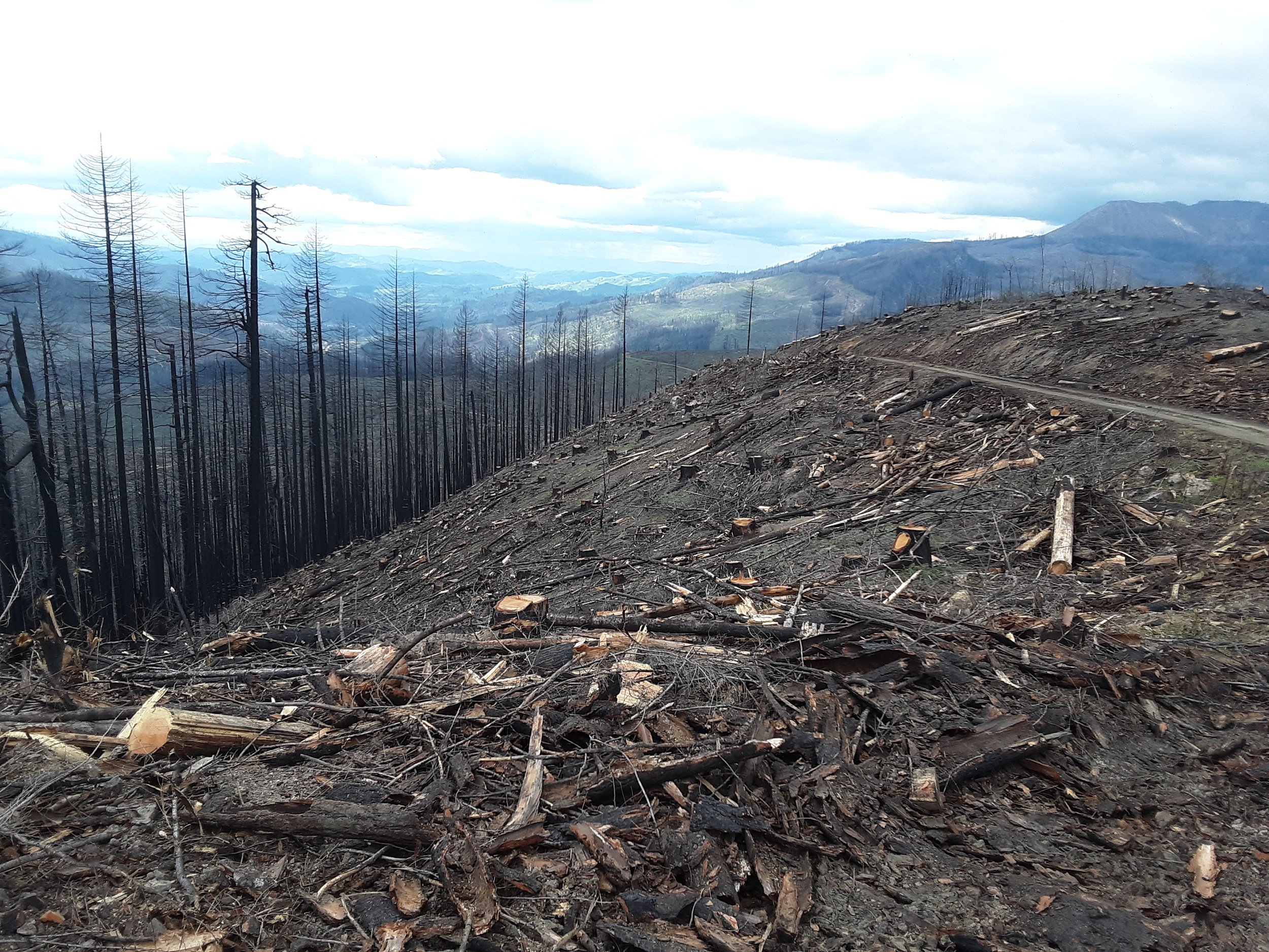
Fremont-Winema National Forest (Oregon) - reburned post-fire logging sale (Credit: Oregon Wild)
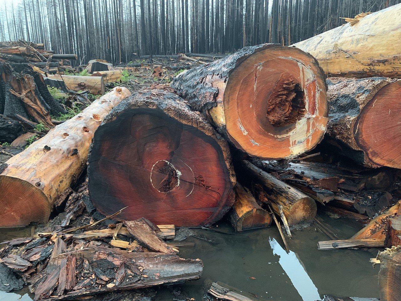
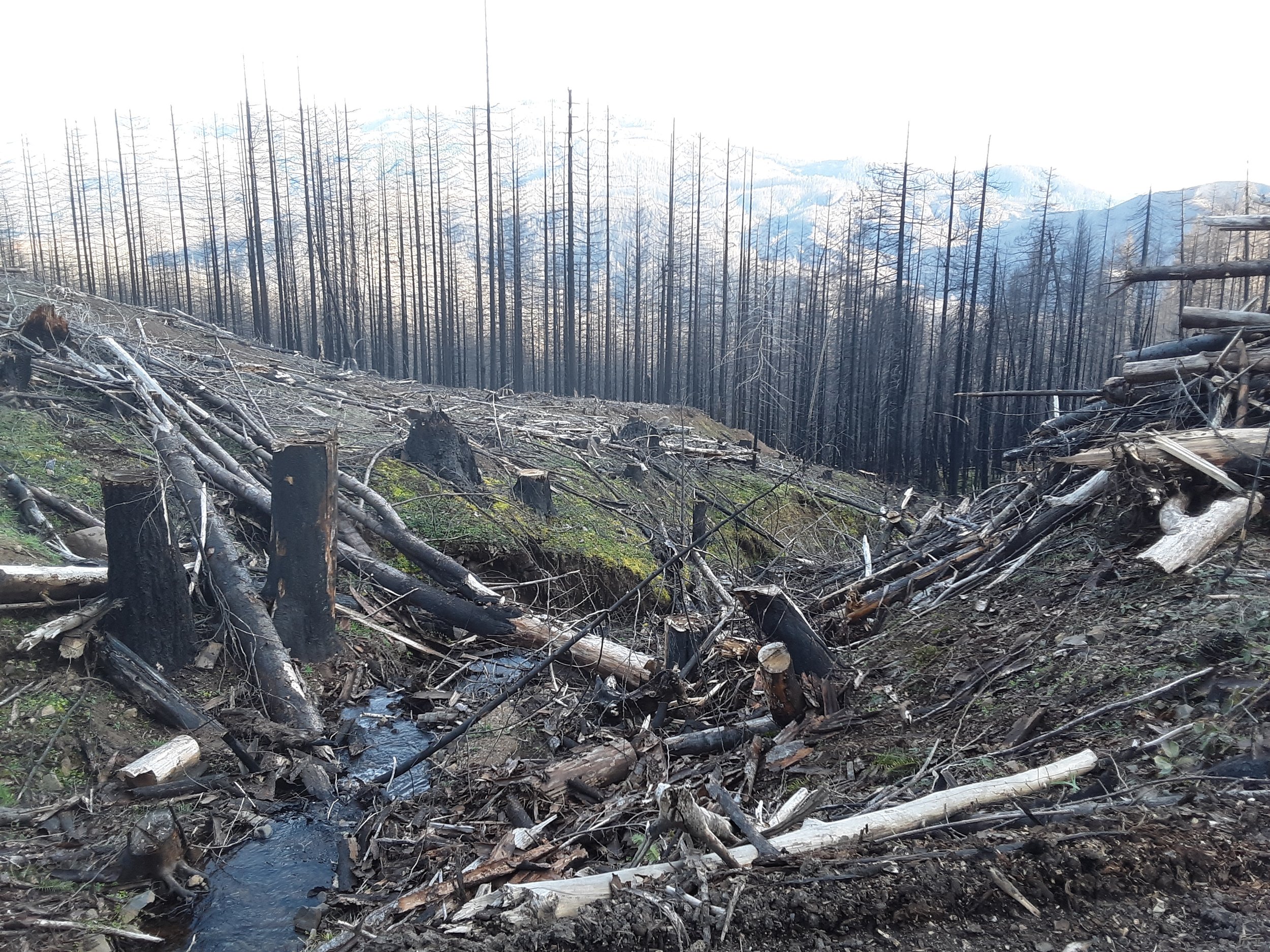
Bureau of Land Management (Oregon) - Archie Creek post-fire logging - Sweet Dreams sale portion (Credit: Steve Cole 2022)
Bureau of Land Management (Oregon) - Archie Creek post-fire logging - Sweet Dreams sale portion (Credit: Steve Cole 2022)
Bureau of Land Management (Oregon) - Archie Creek post-fire logging - Sweet Dreams sale portion (Credit: Steve Cole 2022)
Bureau of Land Management (Oregon) - Archie Creek post-fire logging - Sweet Dreams sale portion (Credit: Steve Cole 2022)
Bureau of Land Management (Oregon) - Archie Creek post-fire logging (Credit: Steve Cole 2022)
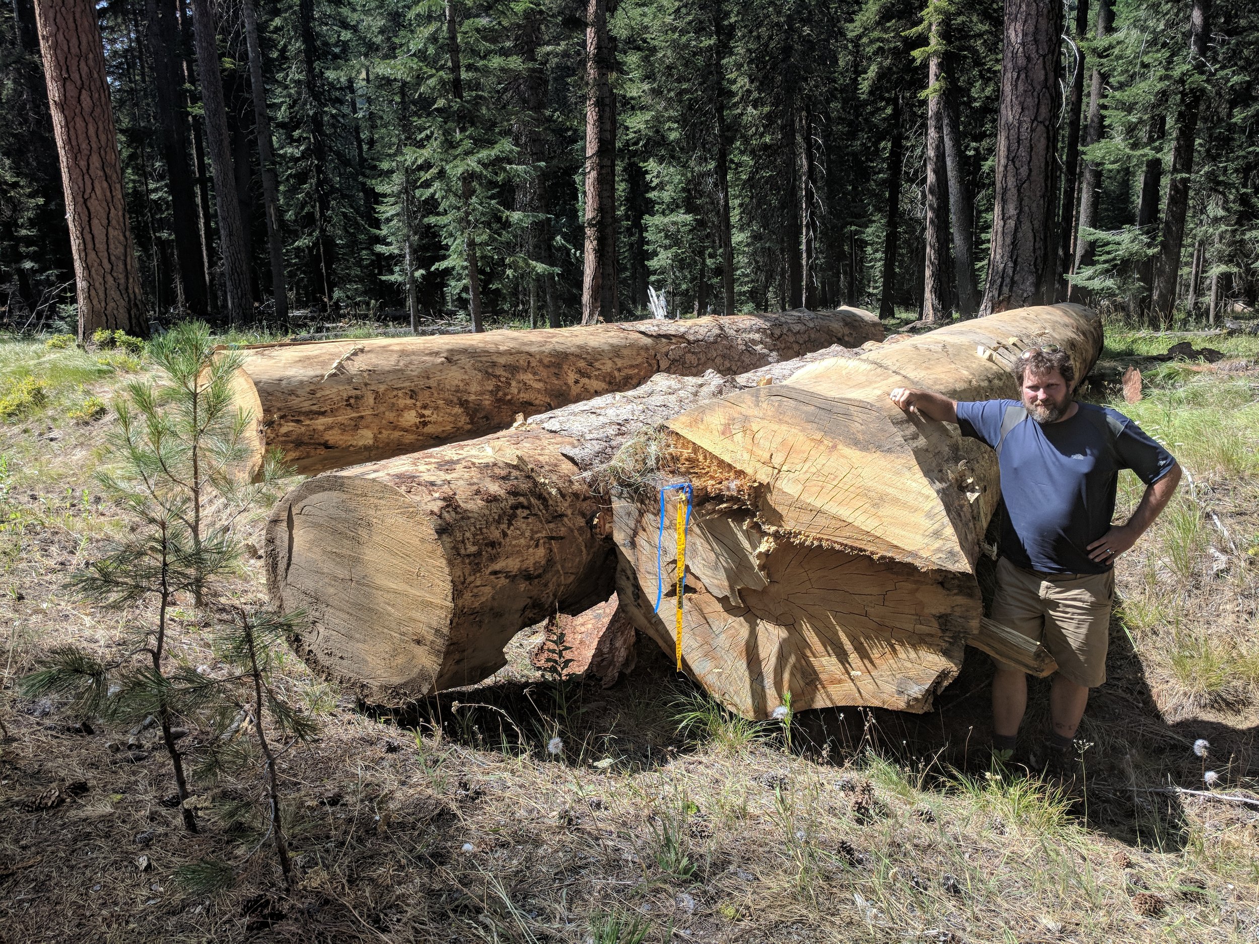
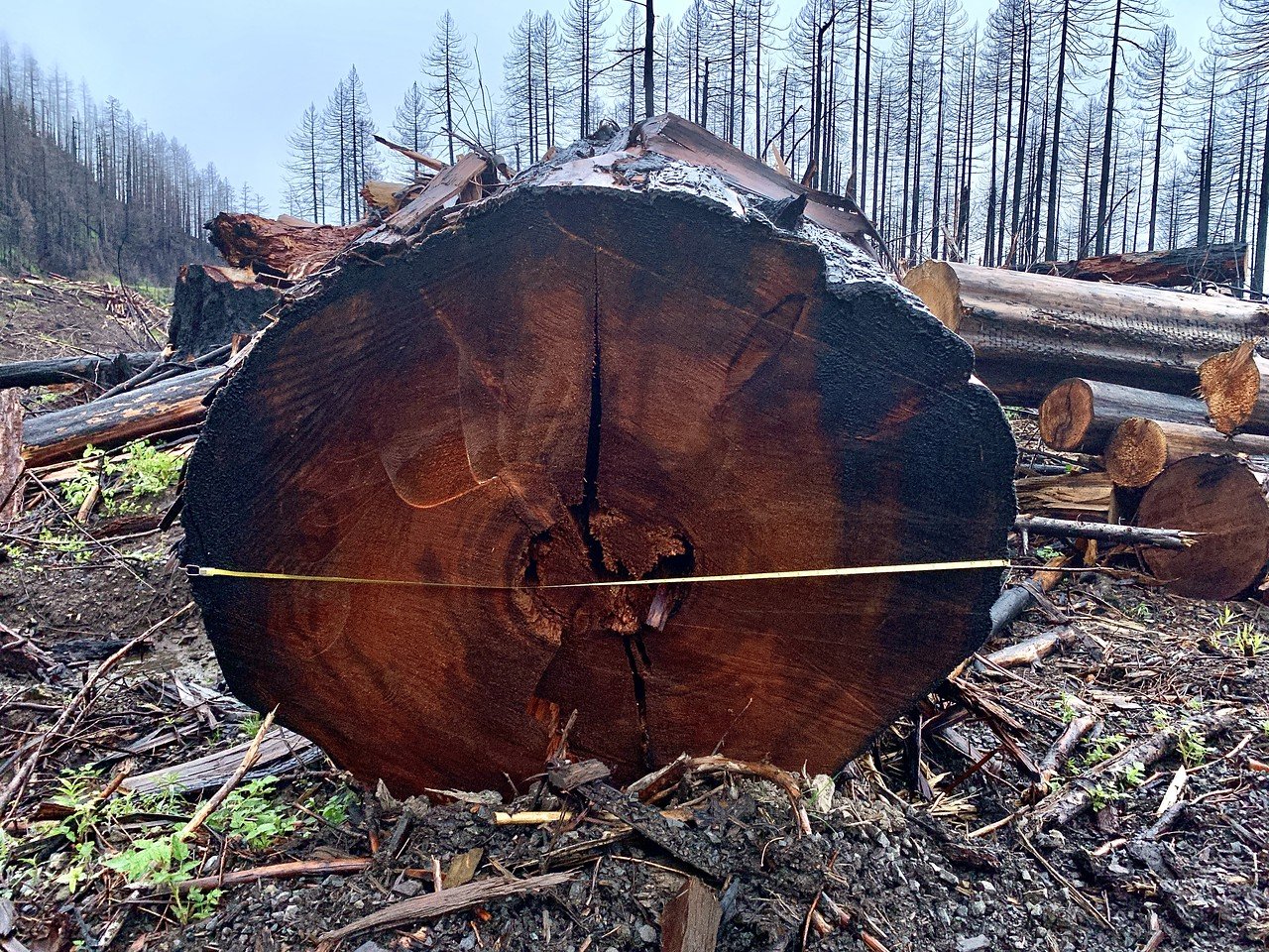
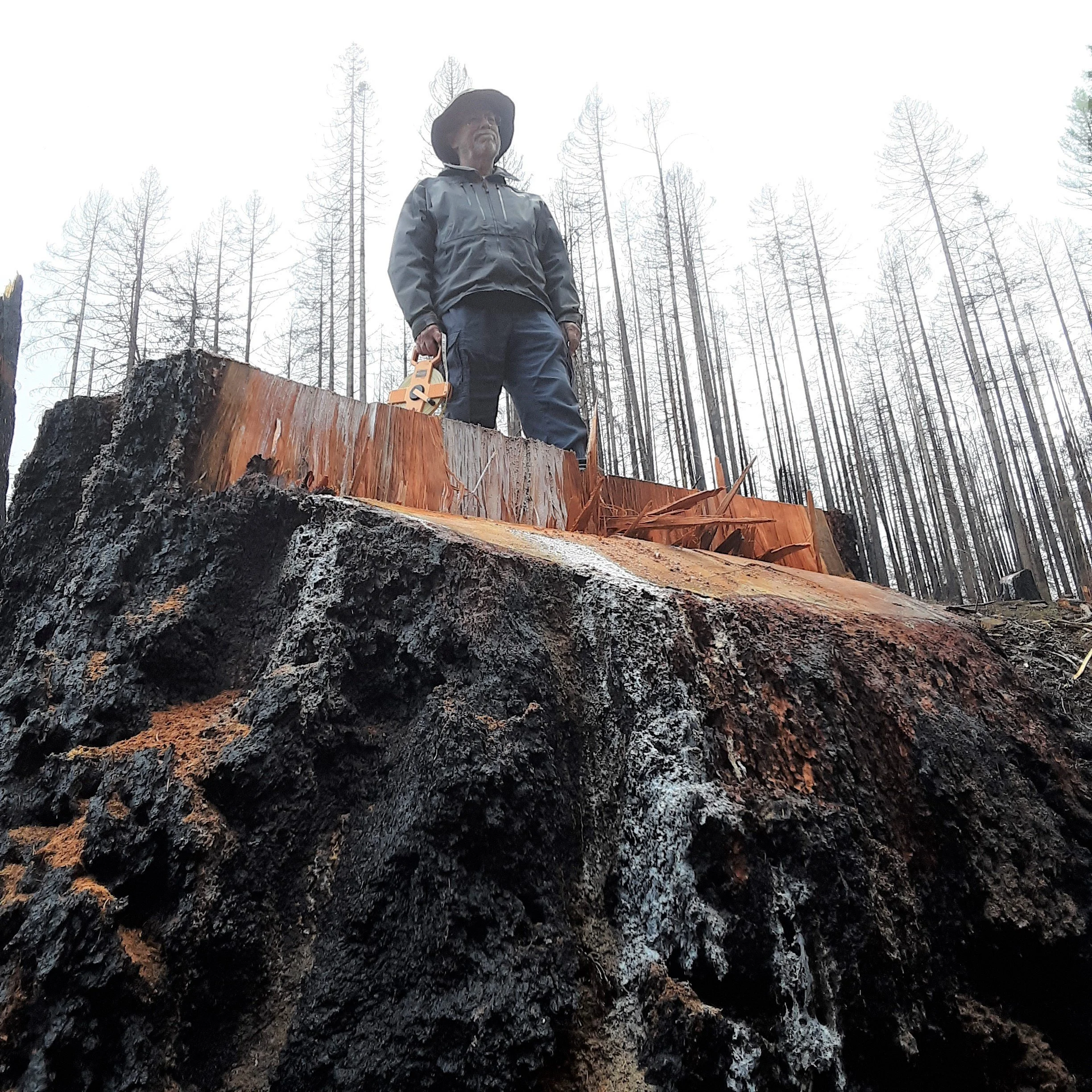
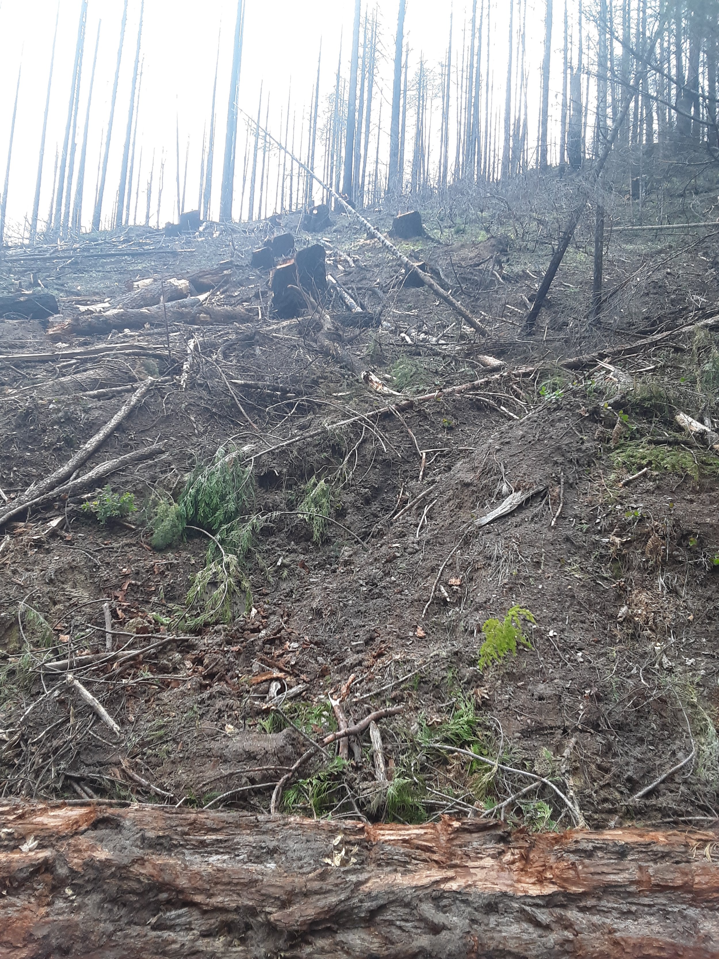
Bureau of Land Management (Oregon) - Archie Creek post-fire logging - Old Fairview Roadside Salvage sale portion - 67"dbh - (Credit: Steve Cole 2022)
Bureau of Land Management (Oregon) - Archie Creek post-fire logging - Old Fairview Roadside Salvage sale portion (Credit: Steve Cole 2022)
Bureau of Land Management (Oregon) - Archie Creek post-fire logging - Old Fairview Roadside Salvage sale portion (Credit: Steve Cole 2022)
Bureau of Land Management (Oregon) - Archie Creek post-fire logging - Old Fairview Roadside Salvage sale portion (Credit: Steve Cole 2022)
Bureau of Land Management (Oregon) - Roseburg District - Bob Butte Right of Way "Hazard" tree logging in Late Successional Reserves (i.e., mature and old forests) and adjacent to spotted owl core habitat (Credit: Umpqua Watersheds)
Bureau of Land Management (Oregon) - Roseburg District - Bob Butte Right of Way "Hazard" tree logging in Late Successional Reserves (i.e., mature and old forests) and adjacent to spotted owl core habitat (Credit: Umpqua Watersheds)
Bureau of Land Management (Oregon) - Roseburg District - Bob Butte Right of Way "Hazard" tree logging in Late Successional Reserves (i.e., mature and old forests) and adjacent to spotted owl core habitat (Credit: Umpqua Watersheds)

Bureau of Land Management (Oregon) - Roseburg District - Hill Creek Right of Way and "Hazard" tree logging in the Archie Creek fire area (Credit: Umpqua Watersheds)

Bureau of Land Management (Oregon) - Roseburg District - Hill Creek Right of Way and "Hazard" tree logging in the Archie Creek fire area (Credit: Umpqua Watersheds)
Bureau of Land Management (Oregon) - Roseburg District - Hill Creek Right of Way and "Hazard" tree logging in the Archie Creek fire area (Credit: Umpqua Watersheds)
Bureau of Land Management (Oregon) - Roseburg District - Hill Creek Right of Way and "Hazard" tree logging in the Archie Creek fire area (Credit: Umpqua Watersheds)
Bureau of Land Management (Oregon) - Roseburg District - Hill Creek Right of Way and "Hazard" tree logging in the Archie Creek fire area (Credit: Umpqua Watersheds)

Bureau of Land Management (Oregon) - Roseburg District - Shoup Creek "Hazard" tree logging within riparian areas (Credit: Umpqua Watersheds)
Bureau of Land Management (Oregon) - Roseburg District - Shoup Creek "Hazard" tree logging within riparian areas (Credit: Umpqua Watersheds)
Bureau of Land Management (Oregon) - Roseburg District - Shoup Creek "Hazard" tree logging within riparian areas (Credit: Umpqua Watersheds)

Bureau of Land Management (Oregon) - Roseburg District - Shoup Creek "Hazard" tree logging within riparian areas (Credit: Umpqua Watersheds)
Examples of fireline logging (coming soon….):